
IMAGES TAKEN NEAR TO
Chapel Lane, TOTNES, TQ9 5AF
Introduction
This page details the photographs taken nearby to Chapel Lane, TQ9 5AF by members of the Geograph project.
The Geograph project started in 2005 with the aim of publishing, organising and preserving representative images for every square kilometre of Great Britain, Ireland and the Isle of Man.

There are currently over 7.5m images from over14,400 individuals and you can help contribute to the project by visiting https://www.geograph.org.uk
Image Map
Images are licensed for reuse under creativecommons.org/licenses/by-sa/2.0
Notes
- Clicking on the map will re-center to the selected point.
- The higher the marker number, the further away the image location is from the centre of the postcode.
Image Listing (508 Images Found)
Images are licensed for reuse under creativecommons.org/licenses/by-sa/2.0
Image
Details
Distance
1
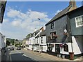
Totnes - Bridgetown
Main street in the Bridgetown suburb, east of Totnes Bridge. The Albert Inn is prominent - with a pictorial pub sign depicting Albert Einstein.
www.visittotnes.co.uk
Image: © Colin Smith
Taken: 26 Jul 2021
0.02 miles
2
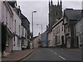
The Albert Inn and the church, Bridgetown
Image: © Rob Purvis
Taken: 4 Oct 2009
0.02 miles
3
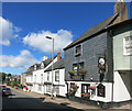
The Albert Inn, Bridgetown
A pub and brewery, the Bridgetown Brewery.
The sign now features Albert Einstein, but what's the betting it was once Prince Albert?
Image: © Des Blenkinsopp
Taken: 26 Aug 2016
0.02 miles
4
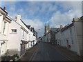
Looking up Bridgetown, Totnes
Bridgetown is both the name of the road and of this part of Totnes. It has its own church
Image: © David Smith
Taken: 22 Oct 2013
0.03 miles
5
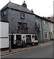
The Albert Inn, Totnes
The name sign on the pub at 32 Bridgetown depicts the most famous Albert of the 20th century -
Albert Einstein.
Image: © Jaggery
Taken: 5 Jul 2014
0.03 miles
6

Blossom, Bridgetown
Cherry blossom against a blue wall outside St John's Church in Bridgetown.
Image: © Derek Harper
Taken: 8 Mar 2011
0.03 miles
7
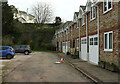
Houses on Rowsell's Lane, Totnes
A modern terrace, with Ashbrook House up the hillside above a couple of retaining walls. This is the end of Rowsell's Lane, but Totnes footpath 4 continues up to the left to meet the A385.
Image: © Derek Harper
Taken: 17 Mar 2021
0.03 miles
8
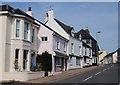
Bridgetown, Totnes
An attractive row of houses on the gentle hill climbing away from Totnes Bridge. The dark slate-hung facade at the far end is the Albert Inn.
Image: © Derek Harper
Taken: 10 May 2008
0.03 miles
9
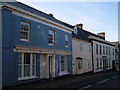
Houses in Bridgetown, Totnes
With a little reflected sunlight from the windows opposite.
Image: © Derek Harper
Taken: 4 Nov 2006
0.03 miles
10
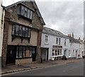
Grade II listed number 5 Bridgetown, Totnes
Number 5 Bridgetown on the left was built as a merchant's house c1600. Grade II listed in 1952.
Bridgetown Butchers shop http://www.geograph.org.uk/photo/4065177 is next door.
Image: © Jaggery
Taken: 5 Jul 2014
0.03 miles