IMAGES TAKEN NEAR TO
Higher Park, KINGSBRIDGE, TQ7 2DB
Introduction
This page details the photographs taken nearby to Higher Park, TQ7 2DB by members of the Geograph project.
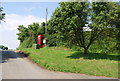
The Geograph project started in 2005 with the aim of publishing, organising and preserving representative images for every square kilometre of Great Britain, Ireland and the Isle of Man.

There are currently over 7.5m images from over14,400 individuals and you can help contribute to the project by visiting https://www.geograph.org.uk
Image Map
Images are licensed for reuse under creativecommons.org/licenses/by-sa/2.0
Notes
- Clicking on the map will re-center to the selected point.
- The higher the marker number, the further away the image location is from the centre of the postcode.
Image Listing (83 Images Found)
Images are licensed for reuse under creativecommons.org/licenses/by-sa/2.0
Image
Details
Distance
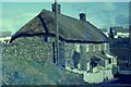
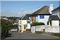
1
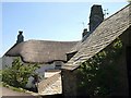
Cottages, East Prawle
A contrast in roofing materials near Town Farm; thatch and slate. The cottages also appear in Image
Image: © Derek Harper
Taken: 8 Jun 2008
0.05 miles
2
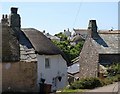
East Prawle
Cottages by Town Farm and Coolings Farm on the northeast side of the village; the valley behind separates them from the main part of the village.
Image: © Derek Harper
Taken: 8 Jun 2008
0.05 miles
3
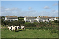
Chivelstone: housing at East Prawle
Seen from the road by Higher Farm
Image: © Martin Bodman
Taken: 3 Sep 2008
0.06 miles
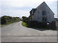
4
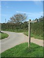
Bridleway sign near Coolings Farm
The other side of the post is a no entry sign
Image: © David Smith
Taken: 29 Sep 2011
0.06 miles
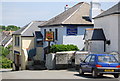
9
Chivelstone: Providence Inn, East Prawle
A rival to the Pig's Nose in the same village
Image: © Martin Bodman
Taken: 3 Sep 2008
0.10 miles
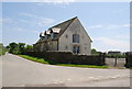
10
Old School
Old School on School Lane East Prawle, built in 1878 closed in 1967. http://www.chivelstoneparishcouncil.gov.uk/Contents/Text/Index.asp?SiteId=38&SiteExtra=8797473&TopNavId=64&NavSideId=5244.
Image: © Shaun Ferguson
Taken: 28 Jul 2009
0.10 miles