IMAGES TAKEN NEAR TO
Knowle Gardens, KINGSBRIDGE, TQ7 1BA
Introduction
This page details the photographs taken nearby to Knowle Gardens, TQ7 1BA by members of the Geograph project.
The Geograph project started in 2005 with the aim of publishing, organising and preserving representative images for every square kilometre of Great Britain, Ireland and the Isle of Man.

There are currently over 7.5m images from over14,400 individuals and you can help contribute to the project by visiting https://www.geograph.org.uk
Image Map
Images are licensed for reuse under creativecommons.org/licenses/by-sa/2.0
Notes
- Clicking on the map will re-center to the selected point.
- The higher the marker number, the further away the image location is from the centre of the postcode.
Image Listing (38 Images Found)
Images are licensed for reuse under creativecommons.org/licenses/by-sa/2.0
Image
Details
Distance
2
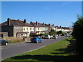
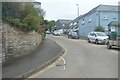
Stentiford Hill, Kingsbridge
This bit of ribbon development is the last stretch of housing on the road north out of Kingsbridge. Seen from close to Coombe Cross.
Image: © Derek Harper
Taken: 24 Aug 2006
0.11 miles
3

Archery Close
Houses on the edge of Kingsbridge.
Image: © Burgess Von Thunen
Taken: 29 Feb 2012
0.12 miles
4
![Kingsbridge houses [7]](https://s3.geograph.org.uk/geophotos/07/57/51/7575191_0fa1575a_120x120.jpg)
Kingsbridge houses [7]
Numbers 132 to 136 Fore Street are three houses in a row. Probably built in the 18th century. Constructed of rubble stone under a tile roof (number 132) or slate roofs (numbers 134 and 136). Listed, grade II, with details at: https://historicengland.org.uk/listing/the-list/list-entry/1249243
Kingsbridge is a market town in the South Hams district of Devon. It is located at the head of an estuary some 17 miles southwest of Torquay and about 17 miles southeast of Plymouth. The town formed around a bridge built in or before the 10th century between two royal estates, giving it the name of Kyngysbrygge ("King's bridge"). Situated in the South Devon Area of Outstanding Natural Beauty and close to the South Devon coast, the town is a popular tourist destination.
Image: © Michael Dibb
Taken: 26 Jun 2023
0.12 miles
5
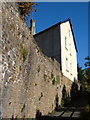
Brookland House
Vertiginously set - or so it seems from this view - above a back road now relegated to a footpath on the northern edge of the town.
Image: © Derek Harper
Taken: 24 Aug 2006
0.13 miles
7
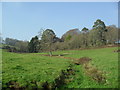
Farmland near Kingsbridge
Pasture land and a stream.
Image: © Burgess Von Thunen
Taken: 29 Feb 2012
0.14 miles