
IMAGES TAKEN NEAR TO
Churston Road, BRIXHAM, TQ5 0JA
Introduction
This page details the photographs taken nearby to Churston Road, TQ5 0JA by members of the Geograph project.
The Geograph project started in 2005 with the aim of publishing, organising and preserving representative images for every square kilometre of Great Britain, Ireland and the Isle of Man.

There are currently over 7.5m images from over14,400 individuals and you can help contribute to the project by visiting https://www.geograph.org.uk
Image Map
Images are licensed for reuse under creativecommons.org/licenses/by-sa/2.0
Notes
- Clicking on the map will re-center to the selected point.
- The higher the marker number, the further away the image location is from the centre of the postcode.
Image Listing (58 Images Found)
Images are licensed for reuse under creativecommons.org/licenses/by-sa/2.0
Image
Details
Distance
1
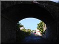
Railway Bridge, Churston Ferrers, near Brixham
At the end of this road, it is designated one way to prevent traffic from getting access to the main road into Brixham as the corner is very difficult to negotiate, the traffic flows fast and the road is narrow. It has made it much quieter for residents.
Image: © Tom Jolliffe
Taken: 3 May 2009
0.03 miles
2
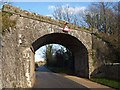
Disused railway bridge, Churston
In 2009 there was a call for a railway line to Brixham to be reopened http://news.bbc.co.uk/1/hi/england/8099912.stm , although as Image points out, there would be difficulties in using the previous route. This bridge still looks pretty solid, though.
Image: © Derek Harper
Taken: 16 Jan 2012
0.08 miles
3
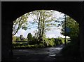
Railway bridge, Churston Ferrers, near Brixham
The Church at Churston can be seen in the distance from under this railway bridge. The "disused railway", discontinued in the Age of Beeching when the car was going to take over the earth...., used to take travellers right into Brixham from all corners of the land. How useful it would be now to see trains running from Brixham to Torquay, Newton Abbot, Exeter and beyond. All these "local" destinations (Exeter is about 25 miles from here) are largely achieved by cars and the Council has been encouraging motorists to share their cars for years, but we are all addicted, it seems.
This railway could not be re-opened, as housing has been built on part of its old course.
Image: © Tom Jolliffe
Taken: 3 May 2009
0.12 miles
4
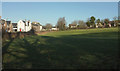
Field, Churston
On the extreme left are the estate cottages https://historicengland.org.uk/listing/the-list/list-entry/1292954 shown in Image Past the white house are four more estate cottages https://historicengland.org.uk/listing/the-list/list-entry/1298245 . The modern houses to the right are on Ferrers Green.
Image: © Derek Harper
Taken: 19 Jan 2020
0.14 miles
5
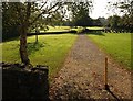
Churchyard, Churston
Neat lawns in the late morning sun. The tombstones in the further section of the churchyard have been placed around the perimeter.
Image: © Derek Harper
Taken: 28 Sep 2008
0.16 miles
6
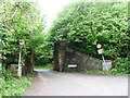
Blown bridge on dismantled railway, Churston Ferrers
Image: © Ruth Sharville
Taken: 15 May 2017
0.16 miles
7
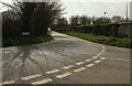
Junction, Churston
The view behind the camera in Image], Image and Image The John Musgrave Heritage Trail arrives from the left and follows Bascombe Road around the left bend.
Image: © Derek Harper
Taken: 20 Mar 2022
0.17 miles
8
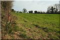
Field, Churston
A view on the other side of the junction shown in Image The trees on the far side are along the line of the dismantled Churston to Brixham railway line.
Image: © Derek Harper
Taken: 20 Mar 2022
0.18 miles
9
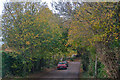
Churston Ferrers : Bascombe Road
Looking along Bascombe Road.
Image: © Lewis Clarke
Taken: 10 Nov 2020
0.18 miles
10
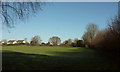
Field, Churston Ferrers
The eastern end of the field shown in Image], again with houses on Ferrers Green, from the path shown in Image
Image: © Derek Harper
Taken: 19 Jan 2020
0.18 miles