Railway bridge, Churston Ferrers, near Brixham
Introduction
The photograph on this page of Railway bridge, Churston Ferrers, near Brixham by Tom Jolliffe as part of the Geograph project.
The Geograph project started in 2005 with the aim of publishing, organising and preserving representative images for every square kilometre of Great Britain, Ireland and the Isle of Man.

There are currently over 7.5m images from over 14,400 individuals and you can help contribute to the project by visiting https://www.geograph.org.uk
Railway bridge, Churston Ferrers, near Brixham
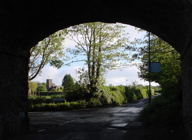
Image: © Tom Jolliffe Taken: 3 May 2009
The Church at Churston can be seen in the distance from under this railway bridge. The "disused railway", discontinued in the Age of Beeching when the car was going to take over the earth...., used to take travellers right into Brixham from all corners of the land. How useful it would be now to see trains running from Brixham to Torquay, Newton Abbot, Exeter and beyond. All these "local" destinations (Exeter is about 25 miles from here) are largely achieved by cars and the Council has been encouraging motorists to share their cars for years, but we are all addicted, it seems. This railway could not be re-opened, as housing has been built on part of its old course.
Images are licensed for reuse under creativecommons.org/licenses/by-sa/2.0
Image Location
Latitude
50.395788
Longitude
-3.543614