1
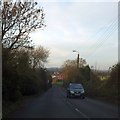
Orange Way in Devon and Torbay (25)
This new roundabout at the industrial estate isn't on my 2002 OS Explorer.
Image: © Shazz
Taken: 16 Oct 2011
0.10 miles
2
Derelict Farm Buildings, Brixham Road
These derelict farm buildings point to a world that existed before the streams of traffic that pour in and out of Brixham all through the year, but most particularly in the summer holiday season. The Brixham Road (the Torbay Ring Road) that currently lies between the photographer and the building was no doubt once relatively quiet. However, it is hard to conceive nowadays that livestock might once have been moved along it. But these buildings attest to the fact that this farm was once a working one and quite large.
Image: © Tom Jolliffe
Taken: 25 Apr 2010
0.11 miles
3
Derelict Farmhouse, Brixham Road
The derelict house on the Brixham Road has continued to decline since the last photograph over three years ago. The window upstairs on the left was visible at that time, but it has now been covered completely by ivy.
Image]
Image: © Tom Jolliffe
Taken: 20 Oct 2013
0.11 miles
4
Former premises of Devon Ceramics Ltd
This distribution warehouse stands at the end of Waddeton Close in an area of significant redevelopment. The building is currently disused, and looks to be due for demolition.
Image: © Richard Dorrell
Taken: 6 Mar 2014
0.12 miles
5
A3022, Brixham Road, passing White Rock
The A3022 runs for a short distance in this grid square, passing White Rock and White Rock School. It is part of the bypass of Paignton. There is no access to the school from the main road
Image: © David Smith
Taken: 11 Dec 2013
0.13 miles
6
Derelict House, Brixham Road
This large house sits on the Brixham Road not far from Windy Corner. Nearby is a group of derelict farm buildings, so in all likelihood it was the farmhouse. The fate of these buildings is not known, but they have been fenced off. The possibility of ribbon development has always been identified along this road. This photograph was taken from a cycle track which runs alongside the road.
Image: © Tom Jolliffe
Taken: 25 Apr 2010
0.15 miles
7
Derelict farmhouse, Brixham Road
The empty farmhouse and the roofless farm buildings nearby are a melancholic sight, if not a little gothic in the extent to which the ivy has climbed up the side of the house and chimney stack and even seems to have entered through the broken window. Early on a damp Sunday morning there is not much traffic, but the house sits in this sad state day after day as the traffic streams by.
Image: © Tom Jolliffe
Taken: 25 Apr 2010
0.15 miles
8
Former RDL Meters building
The building stands at the end of Waddeton Close, in an area undergoing significant redevelopment. This building is clearly currently disused, though is architecturally unusual, and may be being preserved. RDL Meters have relocated onto the nearby Westfield Business Park.
Another view of the building:
Image
Image: © Richard Dorrell
Taken: 6 Mar 2014
0.15 miles
9
Derelict Farmhouse, Brixham Road
The ivy has indeed begun to take up residence on the upper floor. The only redemming feature is the splash of blackthorn blossom in the foreground across the road from the abandoned farm.
Image: © Tom Jolliffe
Taken: 25 Apr 2010
0.15 miles
10
Works on Brixham Road
The works, seen here alongside the A3022 Brixham Road, are part of the major White Rock redevelopment scheme, which will eventually provide more than 30,000 square metres of employment floor space, around 1,200 jobs, 350 homes, a local centre, public open space and all-weather sports pitches, allotments and greater access into the countryside for local residents. The blue and white building on the left is the former Devon Ceramics warehouse. See also:
Image
Image: © Richard Dorrell
Taken: 6 Mar 2014
0.15 miles


