Derelict Farmhouse, Brixham Road
Introduction
The photograph on this page of Derelict Farmhouse, Brixham Road by Tom Jolliffe as part of the Geograph project.
The Geograph project started in 2005 with the aim of publishing, organising and preserving representative images for every square kilometre of Great Britain, Ireland and the Isle of Man.

There are currently over 7.5m images from over 14,400 individuals and you can help contribute to the project by visiting https://www.geograph.org.uk
Derelict Farmhouse, Brixham Road
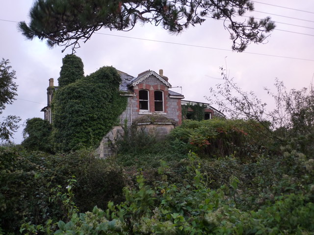
Image: © Tom Jolliffe Taken: 20 Oct 2013
The derelict house on the Brixham Road has continued to decline since the last photograph over three years ago. The window upstairs on the left was visible at that time, but it has now been covered completely by ivy.Image]
Images are licensed for reuse under creativecommons.org/licenses/by-sa/2.0
Image Location
Latitude
50.410262
Longitude
-3.577581