
IMAGES TAKEN NEAR TO
Kingsway Close, PAIGNTON, TQ4 7AE
Introduction
This page details the photographs taken nearby to Kingsway Close, TQ4 7AE by members of the Geograph project.
The Geograph project started in 2005 with the aim of publishing, organising and preserving representative images for every square kilometre of Great Britain, Ireland and the Isle of Man.

There are currently over 7.5m images from over14,400 individuals and you can help contribute to the project by visiting https://www.geograph.org.uk
Image Map
Images are licensed for reuse under creativecommons.org/licenses/by-sa/2.0
Notes
- Clicking on the map will re-center to the selected point.
- The higher the marker number, the further away the image location is from the centre of the postcode.
Image Listing (26 Images Found)
Images are licensed for reuse under creativecommons.org/licenses/by-sa/2.0
Image
Details
Distance
1
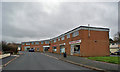
Shops and flats, Kinsway Avenue
Most of the shop units here are closed, and some of the flats above are currently unoccupied. Planning permission exists for the shop units themselves to be converted into flats.
Image: © Richard Dorrell
Taken: 6 Mar 2014
0.07 miles
2
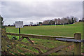
White Rock Recreation Ground
Located just off the Brixham Road. The sign on the left states that a project to level and drain two existing football pitches at the recreation ground will be completed by spring 2004 - so it is probably done by now!
Image: © Richard Dorrell
Taken: 6 Mar 2014
0.11 miles
3
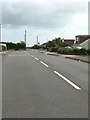
Goodrington Road
Bit of a rat run connecting the Dartmouth road and the Brixham road.
Image: © jeff collins
Taken: 21 Jun 2020
0.11 miles
4

Works on Brixham Road
The works, seen here alongside the A3022 Brixham Road, are part of the major White Rock redevelopment scheme, which will eventually provide more than 30,000 square metres of employment floor space, around 1,200 jobs, 350 homes, a local centre, public open space and all-weather sports pitches, allotments and greater access into the countryside for local residents. The blue and white building on the left is the former Devon Ceramics warehouse. See also: Image
Image: © Richard Dorrell
Taken: 6 Mar 2014
0.12 miles
5
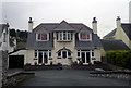
158 Goodrington Road, Paignton
158 Goodrington Road is a large detached property in Paignton, Devon, England. In this shot, its windows are decorated with flags and banners of Liverpool Football Club.
Image: © Steven Haslington
Taken: 17 Sep 2012
0.12 miles
6
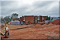
Former RDL Meters building
The building stands at the end of Waddeton Close, in an area undergoing significant redevelopment. This building is clearly currently disused, though is architecturally unusual, and may be being preserved. RDL Meters have relocated onto the nearby Westfield Business Park.
Another view of the building: Image
Image: © Richard Dorrell
Taken: 6 Mar 2014
0.12 miles
7
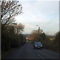
A3022, Brixham Road, passing White Rock
The A3022 runs for a short distance in this grid square, passing White Rock and White Rock School. It is part of the bypass of Paignton. There is no access to the school from the main road
Image: © David Smith
Taken: 11 Dec 2013
0.13 miles
8
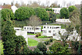
Another Caravan Park, Goodrington
This Park, off Grange Road, Goodrington, is set in amongst residential development
Image: © Crispin Purdye
Taken: 16 Nov 2005
0.14 miles
9
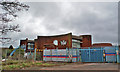
Former RDL Meters building
The building stands at the end of Waddeton Close, in an area undergoing significant redevelopment. This building is clearly currently disused, though is architecturally unusual, and may be being preserved. RDL Meters have relocated onto the nearby Westfield Business Park.
Another view of the building: Image
Image: © Richard Dorrell
Taken: 6 Mar 2014
0.16 miles
10

Brixham Road, Paignton
Pictured here from the central reservation of the A3022 road at the Goodrington Road junction.
The buildings visible are the Premier Inn hotel, the Epic Centre and the Lidl supermarket.
Image: © Richard Dorrell
Taken: 22 Jan 2022
0.17 miles