
IMAGES TAKEN NEAR TO
The Riviera, PAIGNTON, TQ4 5EX
Introduction
This page details the photographs taken nearby to The Riviera, TQ4 5EX by members of the Geograph project.
The Geograph project started in 2005 with the aim of publishing, organising and preserving representative images for every square kilometre of Great Britain, Ireland and the Isle of Man.

There are currently over 7.5m images from over14,400 individuals and you can help contribute to the project by visiting https://www.geograph.org.uk
Image Map
Images are licensed for reuse under creativecommons.org/licenses/by-sa/2.0
Notes
- Clicking on the map will re-center to the selected point.
- The higher the marker number, the further away the image location is from the centre of the postcode.
Image Listing (127 Images Found)
Images are licensed for reuse under creativecommons.org/licenses/by-sa/2.0
Image
Details
Distance
3
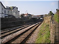
Whitstone Road Railway Bridge
This is a picture of the busy Whitston Road railway bridge taken from the footpath which runs from Whitstone Road to Youngs Park. Of the three tracks showing here, the closest is used by the Paignton and Dartmouth Steam Railway whilst the other two lead from the station to the carriage sidings behind the photographer.
Image: © Terry Butcher
Taken: 8 Mar 2011
0.05 miles
4
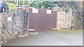
Service Gates
Service gates for block of flats at Fisher St, Paignton
Image: © V1ncenze
Taken: 9 Mar 2020
0.06 miles
5

Path to Whitstone Road
This path runs beside Goodrington carriage sidings and the Dartmouth Steam Railway with the running line nearest.
Image: © DS Pugh
Taken: 1 Jul 2025
0.06 miles
6

Whitstone Road and Roundham Road
Looking across Whitstone Road with the junction onto Roundham Road opposite. The rear of the street sign reads 'Bin juice'.
Image: © DS Pugh
Taken: 1 Jul 2025
0.06 miles
7

Ordnance Survey Bench Mark
This mark is located on a pillar that supports service gates. These marks were used by Ordnance Survey for mapping purposes.
Image: © V1ncenze
Taken: 9 Mar 2020
0.06 miles
8

Remains of the 'Big Tree', Paignton
At the corner of Fisher Street and Dartmouth road. According to www.bigtreeholidayflats.co.uk:
"The Big Tree was a 140 year old Monterey Cypress, which was 92ft tall and a landmark in Paignton. Unfortunately the tree succumbed to disease and on 2nd October 2001 it was finally cut down. Many locals were saddened to see the tree being cut down and were in tears. There was even a last minute legal hitch when Friends of the Earth threatened to take out an injunction to stop the felling. However, talks between them and the council persuaded the campaigners that the ailing tree was too dangerous to leave standing...... Seats and faces were later carved into the stump and it remains a Paignton landmark with many a photo being taken of it
Image: © Tim Heaton
Taken: 10 Feb 2011
0.07 miles
10

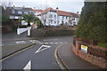
Path beside the railway near Roundham Road
Goodrington carriage sidings and the Dartmouth Steam Railway with the running line nearest.
Image: © DS Pugh
Taken: 1 Jul 2025
0.07 miles