
IMAGES TAKEN NEAR TO
Fore Street, TORQUAY, TQ2 8DP
Introduction
This page details the photographs taken nearby to Fore Street, TQ2 8DP by members of the Geograph project.
The Geograph project started in 2005 with the aim of publishing, organising and preserving representative images for every square kilometre of Great Britain, Ireland and the Isle of Man.

There are currently over 7.5m images from over14,400 individuals and you can help contribute to the project by visiting https://www.geograph.org.uk
Image Map
Images are licensed for reuse under creativecommons.org/licenses/by-sa/2.0
Notes
- Clicking on the map will re-center to the selected point.
- The higher the marker number, the further away the image location is from the centre of the postcode.
Image Listing (137 Images Found)
Images are licensed for reuse under creativecommons.org/licenses/by-sa/2.0
Image
Details
Distance
1
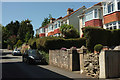
Houses on Fore Street, Barton
Facing the afternoon sun from the northeast side of the road. On the extreme left is the junction with Langford Crescent.
Image: © Derek Harper
Taken: 27 Jun 2018
0.01 miles
2
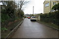
Langford Crescent
Langford Crescent, Barton, Torquay.
Image: © John C
Taken: 29 Mar 2018
0.02 miles
3
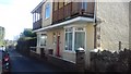
Former Barton Post Office
The house is the original Barton Post Office in Fore Street, Barton. Half the property was the shop, and the Post Master living in the other half.
Today the house bears the name, 'The Old Post Office'.
Image: © John C
Taken: 15 Mar 2018
0.03 miles
4
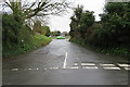
Un-named road - TQ2 8LT
An in-names stretch of road that links Fore Street with Isaacs Road at the junction with Barton Hill Road. Google Maps identifies the road as having postcode TQ2 8LT.
Image: © John C
Taken: 29 Mar 2018
0.03 miles
5
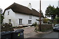
Thatched cottage
Thatched cottage in Fore Street, the old part of Barton.
Image: © John C
Taken: 29 Mar 2018
0.03 miles
6
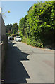
Fore Street, Barton
Not a great road for the pedestrian, but fortunately not very busy either.
Image: © Derek Harper
Taken: 27 Jun 2018
0.04 miles
7
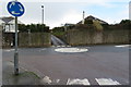
Mini roundabout - Barton Hill Road
The mini roundabout at the junction of Isaacs Road and Barton Hill Road. The small lane ahead is Suncrest Close.
Image: © John C
Taken: 29 Mar 2018
0.05 miles
8
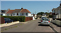
Isaacs Road, Barton
Further along is the left turn down the road where Image]; beyond are houses shown from the other direction in Image
Image: © Derek Harper
Taken: 27 Jun 2018
0.05 miles
9
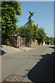
Fore Street, Barton
Image: © Derek Harper
Taken: 27 Jun 2018
0.05 miles
10
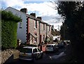
Fore Street, Barton
Beyond the three Victorian cottages is the thatched C16-C17 Old Manor Farmhouse, "a good example of an evolved house of late medieval origins in an area of the county mostly developed in the C19". http://www.imagesofengland.org.uk/Details/Default.aspx?id=390608&mode=adv . Seen from the junction with Barton Hill Road, closed off to traffic.
Image: © Derek Harper
Taken: 7 Feb 2009
0.05 miles