
IMAGES TAKEN NEAR TO
Broadpark Road, TORQUAY, TQ2 6UJ
Introduction
This page details the photographs taken nearby to Broadpark Road, TQ2 6UJ by members of the Geograph project.
The Geograph project started in 2005 with the aim of publishing, organising and preserving representative images for every square kilometre of Great Britain, Ireland and the Isle of Man.

There are currently over 7.5m images from over14,400 individuals and you can help contribute to the project by visiting https://www.geograph.org.uk
Image Map
Images are licensed for reuse under creativecommons.org/licenses/by-sa/2.0
Notes
- Clicking on the map will re-center to the selected point.
- The higher the marker number, the further away the image location is from the centre of the postcode.
Image Listing (150 Images Found)
Images are licensed for reuse under creativecommons.org/licenses/by-sa/2.0
Image
Details
Distance
1
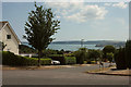
Pentridge Avenue, Livermead
Looking across the junction with Broadpark Road, with a view across Tor Bay.
Image: © Derek Harper
Taken: 20 Jul 2018
0.04 miles
2
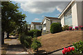
Broadpark Road, Livermead
These houses are just north of a grid line which runs along Broadpark Road here.
Image: © Derek Harper
Taken: 20 Jul 2018
0.04 miles
3
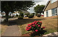
Broadpark Road, Livermead
Parched gardens near the junction with Broadley Drive, but the hydrangeas have survived.
Image: © Derek Harper
Taken: 20 Jul 2018
0.04 miles
4
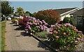
Hydrangeas, Purbeck Avenue, Broadpark
Holding up reasonably well in a heatwave.
Image: © Derek Harper
Taken: 21 Jul 2021
0.04 miles
5
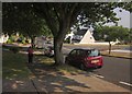
Broadpark Road, Livermead
From the junction of Broadley Drive. On the right is the junction with the Old Paignton Road. Light and shade contrast overpoweringly.
Image: © Derek Harper
Taken: 21 Jul 2013
0.05 miles
6
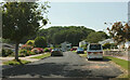
Purbeck Avenue, Broadpark
Note the lay-bys for convenient parking; obviously someone foresaw the chaos that accompanies the dropping-off and collecting of children from the nearby primary school; an impressive display was taking place when I took this. The wood is Ten Acre Brake.
Image: © Derek Harper
Taken: 21 Jul 2021
0.05 miles
7
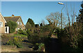
Chiltern Close, Livermead
A little further from Image] along the close named after the path rather than the road on the other side of each row of semis.
Image: © Derek Harper
Taken: 18 Feb 2021
0.06 miles
8
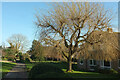
Willow, Chiltern Close, Livermead
By the path that runs between houses on either side, all on Chiltern Close. Even number are on the left, as shown in Image], and odd numbers on the right; a slightly unusual arrangement.
Image: © Derek Harper
Taken: 18 Feb 2021
0.07 miles
9
Chiltern Close, Livermead
Houses with a path along the rear and vehicle access on the other side, where they face houses with a different address.
Image: © Derek Harper
Taken: 18 Feb 2021
0.08 miles
10
Traffic queue, Livermead
Traffic queues on Old Paignton Road, an unlikely spot for a traffic jam. Usually traffic chaos in the area is caused by the closure of the coast road at Livermead because of high winds and tides. On this occasion the road closure is because of an incident involving a seriously-injured man found in a vehicle. Buses had a longer diversion via the ring road - probably quicker than this almost immobile queue though. View from Roundhill Road.
Image: © Derek Harper
Taken: 31 Oct 2017
0.08 miles