
IMAGES TAKEN NEAR TO
Roundhill Road, TORQUAY, TQ2 6TH
Introduction
This page details the photographs taken nearby to Roundhill Road, TQ2 6TH by members of the Geograph project.
The Geograph project started in 2005 with the aim of publishing, organising and preserving representative images for every square kilometre of Great Britain, Ireland and the Isle of Man.

There are currently over 7.5m images from over14,400 individuals and you can help contribute to the project by visiting https://www.geograph.org.uk
Image Map
Images are licensed for reuse under creativecommons.org/licenses/by-sa/2.0
Notes
- Clicking on the map will re-center to the selected point.
- The higher the marker number, the further away the image location is from the centre of the postcode.
Image Listing (158 Images Found)
Images are licensed for reuse under creativecommons.org/licenses/by-sa/2.0
Image
Details
Distance
1
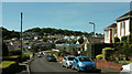
Roundhill Road, Livermead
The road runs down to a parade of shops on the right and a T junction with Old Paignton Road.
Image: © Derek Harper
Taken: 8 Jun 2021
0.02 miles
2
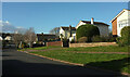
Broadpark Road, Livermead
Approaching the junction with Manscombe Road.
Image: © Derek Harper
Taken: 18 Feb 2021
0.04 miles
3
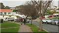
Traffic queue, Livermead
Traffic queues on Old Paignton Road, an unlikely spot for a traffic jam. Usually traffic chaos in the area is caused by the closure of the coast road at Livermead because of high winds and tides. On this occasion the road closure is because of an incident involving a seriously-injured man found in a vehicle. Buses had a longer diversion via the ring road - probably quicker than this almost immobile queue though. View from Roundhill Road.
Image: © Derek Harper
Taken: 31 Oct 2017
0.05 miles
4
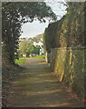
Path along Broadpark Road, Livermead
The path runs behind trees, separating it from the road for well over 100 metres and guiding the pedestrian to a relatively safe crossing at the junction behind the camera shown in Image
Image: © Derek Harper
Taken: 15 Jan 2021
0.05 miles
5
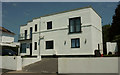
Modernist house, Livermead
Number 2, Roundhill Road. "1938c" http://www.ukmoho.co.uk/html/building/3508.html but no architect given. It backs onto a house designed by Edwin Lutyens' son Robert.
Image: © Derek Harper
Taken: 25 Jun 2020
0.05 miles
6
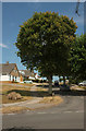
Manscombe Road, Livermead
Looking across Broadpark Road.
Image: © Derek Harper
Taken: 20 Jul 2018
0.06 miles
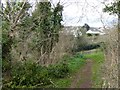
8
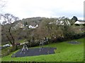
Playground near Preston Primary School
Beyond the playground, there is a row of cars parked in Old Paignton Road, waiting to collect pupils from the school which is a little higher up the hill
Image: © David Smith
Taken: 27 Jan 2015
0.07 miles
9
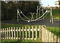
Playground, Old Paignton Road
Image: © Derek Harper
Taken: 30 Oct 2017
0.07 miles
10
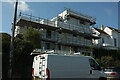
Mango House, Livermead
Under repair, this house on Mead Road was designed by Robert Lutyens, son of Edwin Lutyens. Also shown in Image http://www.ukmoho.co.uk/html/building/21220.html
Image: © Derek Harper
Taken: 2 Sep 2023
0.07 miles