
IMAGES TAKEN NEAR TO
Chichester Close, TEIGNMOUTH, TQ14 9FE
Introduction
This page details the photographs taken nearby to Chichester Close, TQ14 9FE by members of the Geograph project.
The Geograph project started in 2005 with the aim of publishing, organising and preserving representative images for every square kilometre of Great Britain, Ireland and the Isle of Man.

There are currently over 7.5m images from over14,400 individuals and you can help contribute to the project by visiting https://www.geograph.org.uk
Image Map
Images are licensed for reuse under creativecommons.org/licenses/by-sa/2.0
Notes
- Clicking on the map will re-center to the selected point.
- The higher the marker number, the further away the image location is from the centre of the postcode.
Image Listing (56 Images Found)
Images are licensed for reuse under creativecommons.org/licenses/by-sa/2.0
Image
Details
Distance
1
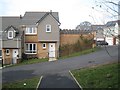
Chichester Close, New Horizons estate off Drake Avenue, Teignmouth
Teignmouth's steep slopes have been a challenge for developers since the early nineteenth century.
Image: © Robin Stott
Taken: 11 Dec 2012
0.01 miles
2
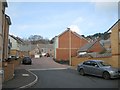
Drake Avenue extension, New Horizons estate, Teignmouth
Some streetmaps call it Drakes Avenue. Seen from the corner of Shackleton Walk. The state was completing from 2010.
Image: © Robin Stott
Taken: 11 Dec 2012
0.02 miles
3
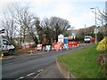
Streetworks on Higher Exeter Road, Teignmouth
Works being carried out by SWH could be connected with the New Horizons development, completing from 2010, that is an extension of Drake Avenue, glimpsed through the trees: perhaps installing new telephone poles or streetlighting columns.
SWH is South West Highways http://www.swhltd.co.uk There's a sense that they might be a company created from the highways and engineering departments of Devon County Council.
Image: © Robin Stott
Taken: 11 Dec 2012
0.03 miles
4
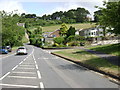
Higher Exeter Road and Breakneck Hill, Teignmouth
The Exeter road bends to the left. Breakneck continues up the hill, even more steeply, towards Holcombe Down. Junction with Maudlin Drive, right.
Image: © Robin Stott
Taken: 7 Jun 2009
0.03 miles
5
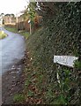
Breakneck Hill
See Image; this shows the street sign at the bottom of the hill.
Image: © Derek Harper
Taken: 13 Feb 2009
0.04 miles
6
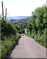
Breakneck Hill, Teignmouth
Climbing up from Higher Exeter Road, centre. The Ness appears, left, across the River Teign, with Hope's Nose and the heights of Watcombe beyond on the north side of Torbay.
Image: © Robin Stott
Taken: 7 Jun 2009
0.04 miles
7
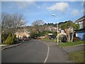
North on Drake Avenue, Teignmouth
The older part of Drake Avenue ends beyond the red car. It continues into the New Horizons estate which was completing from 2010.
Image: © Robin Stott
Taken: 11 Dec 2012
0.04 miles
8
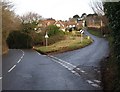
Breakneck Hill and Exeter Road
The main road to Exeter, the B3192, climbs away from Teignmouth on the left. Climbing a good deal more rapidly, up to Holcombe Down, is Breakneck Hill on the right.
Image: © Derek Harper
Taken: 13 Feb 2009
0.05 miles
9
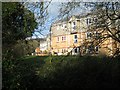
Rear of Shackleton Walk, New Horizons estate off Drake Avenue, Teignmouth
Glimpsed from the footpath behind Frobisher Close. Shackleton Walk adjoins Frobisher Wood, left distance, a natural open space.
Image: © Robin Stott
Taken: 11 Dec 2012
0.06 miles
10
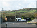
Road junction at the back of Teignmouth
Image: © Sarah Charlesworth
Taken: 22 Nov 2009
0.06 miles