
IMAGES TAKEN NEAR TO
Broadmeadow Industrial Estate, TEIGNMOUTH, TQ14 9AE
Introduction
This page details the photographs taken nearby to Broadmeadow Industrial Estate, TQ14 9AE by members of the Geograph project.
The Geograph project started in 2005 with the aim of publishing, organising and preserving representative images for every square kilometre of Great Britain, Ireland and the Isle of Man.

There are currently over 7.5m images from over14,400 individuals and you can help contribute to the project by visiting https://www.geograph.org.uk
Image Map
Images are licensed for reuse under creativecommons.org/licenses/by-sa/2.0
Notes
- Clicking on the map will re-center to the selected point.
- The higher the marker number, the further away the image location is from the centre of the postcode.
Image Listing (188 Images Found)
Images are licensed for reuse under creativecommons.org/licenses/by-sa/2.0
Image
Details
Distance
1
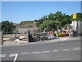
Compounds for open storage, Broadmeadow industrial estate, Teignmouth
The estate climbs a hillside. Across the valley can be seen Newfoundland Road, access to the Morrisons superstore, on its concrete-sprayed bank.
The connection between Teignmouth and Newfoundland is cod. From the sixteenth century, Teignmouth fishermen sailed the North Atlantic to fish the Grand Banks.
Image: © Robin Stott
Taken: 6 Jul 2013
0.01 miles
2
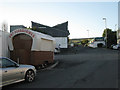
Snack wagon, Broadmeadow Industrial Estate, Teignmouth
This view is the reverse of Image
Image: © Robin Stott
Taken: 29 Sep 2010
0.02 miles
3

Sign displaying plan of Broadmeadow industrial estate, Teignmouth
Image: © Robin Stott
Taken: 6 Jul 2013
0.02 miles
4
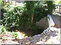
Brook through Broadmeadow industrial estate, Teignmouth
The OS map shows, a little way upstream (left), Issues, although the brook probably comes down the length of Broadmeadow. The local street map shows the name 'Daymans' alongside the brook, as though it were a housename, but the only feature in that position is a gas installation. Old maps do not show a property there: a puzzle. The watercourse runs down a narrow green corridor through the industrial estate, then under Bishopsteignton Road to join the River Teign.
Image: © Robin Stott
Taken: 6 Jul 2013
0.03 miles
5
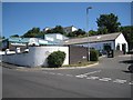
Businesses, Broadmeadow industrial estate, Teignmouth
Image: © Robin Stott
Taken: 6 Jul 2013
0.03 miles
6
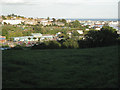
Western edge of Teignmouth: 2
The Broadmeadow industrial estate sprawls across the middle of this view from The Lea near the southern edge of the square. Broadmeadow Lane runs behind the development. Allotments spread up the steep hillside to houses and flats in Kingsway Image and the Kingsdown area Image The distant river Teign, the harbour and the lower part of the town appear on the right. The view continues to the left in Image
Image: © Robin Stott
Taken: 29 Sep 2010
0.03 miles
7
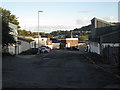
Broadmeadow Industrial Estate, Teignmouth: 2
Looking south out of the square, with Shaldon in the background across the river. This view is the reverse of Image
Image: © Robin Stott
Taken: 29 Sep 2010
0.03 miles
8
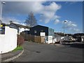
Broadmeadow Industrial Estate,Teignmouth
The central unit is occupied by a construction firm. The no through road through the estate also leads to Broadmeadow Sports Centre.
Image: © Derek Harper
Taken: 4 Mar 2012
0.03 miles
9
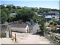
Substation, Broadmeadow industrial estate, Teignmouth
The new view from new Newfoundland Road. The County Engineer's depot, shown on the local street map as a turning off The Lea, appears now to be accessed from the industrial estate. The connection between Teignmouth and Newfoundland is cod. From the sixteenth century, Teignmouth fishermen sailed the North Atlantic to fish the Grand Banks.
On the skyline are flats and houses along Kingsway.
Image: © Robin Stott
Taken: 6 Jul 2013
0.04 miles
10
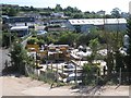
Builders? merchant, Broadmeadow industrial estate, Teignmouth
A branch of Travis Perkins at the time of the photo. This new view is from the new Newfoundland Road up to the new Morrisons supermarket.
The connection between Teignmouth and Newfoundland is cod. From the sixteenth century, Teignmouth fishermen sailed the North Atlantic to fish the Grand Banks.
Image: © Robin Stott
Taken: 6 Jul 2013
0.04 miles