IMAGES TAKEN NEAR TO
New Road, TEIGNMOUTH, TQ14 8UE
Introduction
This page details the photographs taken nearby to New Road, TQ14 8UE by members of the Geograph project.
The Geograph project started in 2005 with the aim of publishing, organising and preserving representative images for every square kilometre of Great Britain, Ireland and the Isle of Man.

There are currently over 7.5m images from over14,400 individuals and you can help contribute to the project by visiting https://www.geograph.org.uk
Image Map
Images are licensed for reuse under creativecommons.org/licenses/by-sa/2.0
Notes
- Clicking on the map will re-center to the selected point.
- The higher the marker number, the further away the image location is from the centre of the postcode.
Image Listing (62 Images Found)
Images are licensed for reuse under creativecommons.org/licenses/by-sa/2.0
Image
Details
Distance
1
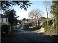
West and downhill on New Road, Teignmouth
New Road is a fast, busy distributor road across Teignmouth's hilly northern suburbs and connecting Dawlish Road to Exeter Road. Along it are a number of substantial Victorian villas, many with later development in their grounds.
Image: © Robin Stott
Taken: 10 Dec 2012
0.01 miles
4
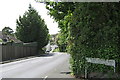
New Road
The switchback that is New Road, centre, is a handy east-west route across northern Teignmouth.
Image: © Robin Stott
Taken: 17 May 2009
0.03 miles
5
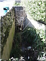
The Brimley Brook on Maudlin Drive
The brook has two branches running from Holcombe Down; this is the eastern, briefly emerging into view before returning to the culvert. Today it is little more than a trickle.
Image: © Neil Owen
Taken: 30 Mar 2024
0.05 miles
6
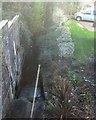
A brook emerges from beneath New Road, heading down the Brimley Valley
Image: © Robin Stott
Taken: 10 Dec 2012
0.05 miles
7
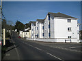
New flats, New Road, corner of Stapleford Drive
Image: © Robin Stott
Taken: 6 May 2012
0.07 miles
8
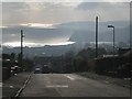
The view down Maudlin Drive, Teignmouth
I'd taken one of the town buses for the steep mile up from the town centre to these hillside residential roads, turned round and was stunned by the view, the reflected sun and the procession of cloud shadows over the sea. In the distance is Thatcher Rock and Hope's Nose, the northern tip of Torbay. Closer to the camera is the Ness across the River Teign, and Teignmouth pier on the left.
Image: © Robin Stott
Taken: 11 Dec 2012
0.08 miles
9
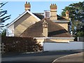
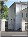
Large house of cream brick, corner of New Road and Stapleford Drive
It is believed that the cream bricks seen in Teignmouth and elsewhere where made at a brickworks in Kingsteignton using the fine clay from the Bovey Basin. The bricks were hard and strong, more like a ceramic. There are many houses in the area of orange brick that use courses of cream brick for strength at corners and for door and window surrounds. Far fewer houses are built of the cream brick, with details in orange brick or the pale grey Devonian limestone.
Image: © Robin Stott
Taken: 10 Dec 2012
0.08 miles
10
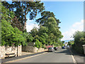
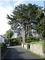
Woodway Road, Teignmouth
The older suburbs of Teignmouth, with mature trees, large houses and luxuriant hedges.
Image: © Des Blenkinsopp
Taken: 17 Jun 2016
0.09 miles