IMAGES TAKEN NEAR TO
Haytor, NEWTON ABBOT, TQ13 9XX

Introduction

This page details the photographs taken nearby to TQ13 9XX by members of the Geograph project.

The Geograph project started in 2005 with the aim of publishing, organising and preserving representative images for every square kilometre of Great Britain, Ireland and the Isle of Man.

There are currently over 7.5m images from over14,400 individuals and you can help contribute to the project by visiting https://www.geograph.org.uk

Image Map


Images are licensed for reuse under creativecommons.org/licenses/by-sa/2.0
Notes
  • Clicking on the map will re-center to the selected point.
  • The higher the marker number, the further away the image location is from the centre of the postcode.

Image Listing (20 Images Found)

Images are licensed for reuse under creativecommons.org/licenses/by-sa/2.0
Image
Details
Distance
1
The Shotts, Haytor Vale
View along the Shotts, a private road/footpath that leads to Haytor Vale.
Image: © Alan Hunt Taken: 20 Jun 2010
0.04 miles
2
The Shotts, Haytor Vale
View west along the Shotts. The woods mark the line of the stream that runs down towards Smallacombe Farm.
Image: © Alan Hunt Taken: 20 Jun 2010
0.05 miles
3
The Shotts, Haytor Vale
View across the field at the end of the Shotts. The woods follow the line of the stream that runs down towards Smallacoombe.
Image: © Alan Hunt Taken: 20 Jun 2010
0.08 miles
4
The Shotts, Haytor Vale
A fenced-in pine sapling in the field to the south of the Shotts.
Image: © Alan Hunt Taken: 20 Jun 2010
0.09 miles
5
Resting on the tramway
These cattle (the black and white one is a Belted Galloway) are on the route of the former Haytor granite tramway, now a long distance path the Templer Way. I wonder if the tramway workers had similar sit-ins when it was operational from 1820 to 1858?
Image: © Graham Horn Taken: 31 Aug 2012
0.10 miles
6
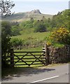
Gate by the B3387
With the backdrop of Haytor and woodland at Middle Shotts.
Image: © Derek Harper Taken: 18 May 2014
0.12 miles
7
The Shotts, Haytor Vale
The western end of the Shotts with a view of Shotts House. An old photograph shows a large circular powder magazine in the garden for storing explosives used in the adjoining Haytor Iron Mine.
Image: © Alan Hunt Taken: 20 Jun 2010
0.13 miles
8
Haytor granite tramway
This is part of the Haytor tramway, that took granite from quarries around Haytor to the Stover Canal and River Teign from 1820 to 1858. The route is now used by the Templer Way, commemorating the Templer family, who managed the quarries and supervised the construction of the tramway. Here it runs parallel to the road from Haytor to Bovey Tracey.
Image: © Graham Horn Taken: 31 Aug 2012
0.13 miles
9
Bridleway near Smallacombe
This bridleway climbs from Image to the B3387 at the top of Green Lane on the edge of Haytor Down.
Image: © Derek Harper Taken: 25 Mar 2009
0.17 miles
10
Bridleway to Smallacombe
Looking down towards Smallacombe from near the top of Image, which here is a concrete track leading to several properties.
Image: © Derek Harper Taken: 25 Mar 2009
0.17 miles