IMAGES TAKEN NEAR TO
Manaton, NEWTON ABBOT, TQ13 9UD
Introduction
This page details the photographs taken nearby to TQ13 9UD by members of the Geograph project.
The Geograph project started in 2005 with the aim of publishing, organising and preserving representative images for every square kilometre of Great Britain, Ireland and the Isle of Man.

There are currently over 7.5m images from over14,400 individuals and you can help contribute to the project by visiting https://www.geograph.org.uk
Image Map
Images are licensed for reuse under creativecommons.org/licenses/by-sa/2.0
Notes
- Clicking on the map will re-center to the selected point.
- The higher the marker number, the further away the image location is from the centre of the postcode.
Image Listing (18 Images Found)
Images are licensed for reuse under creativecommons.org/licenses/by-sa/2.0
Image
Details
Distance
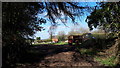
3
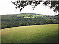
Dartmoor Way
On the lane from Beckhams to Water.
Image: © Guy Wareham
Taken: 1 Nov 2010
0.09 miles
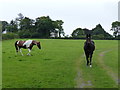
7
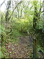
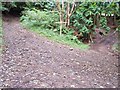
Footpath along fence above Becka Falls
The path is a right of way; access to the land around Becka Falls is limited to paying visitors
Image: © David Smith
Taken: 4 Nov 2019
0.19 miles
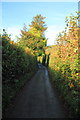
8
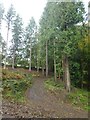
Track on north-east edge of Houndtor Wood
Image: © David Smith
Taken: 4 Nov 2019
0.22 miles
9
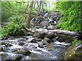
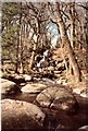
Dartmoor: Becky Falls
From a strictly physical geographical point of view this is the Becka Falls waterfall on the Becka Brook, which is a tributary of the River Bovey. The water cascades here over a boulder-strewn bed with a fall of about 70 feet or about 20 metres.
However the land in which they occur is privately owned, and the owners have unsurprisingly turned the site into a tourist attraction in which the falls are the centrepiece of a woodland park containing a variety of different features such as a children's zoo, pony paddocks, and the inevitable gift shop. In the course of this commercialization the name of the falls has metamorphosed from Becka, as shown on the OS 1940s map, into Becky, as shown on the current OS map. The falls were first made accessible to the public in 1903, and the park's website is here http://www.beckyfalls.com/index.php Adult admittance in May 2007 was £5.75 per person.
Image: © Nigel Cox
Taken: 9 May 2007
0.22 miles
10
The old road from Manaton to Bovey Tracey
The Medieval road from Manaton to Bovey Tracey leads from top left to bottom right. It's only a byway now.
The signpost reads: (left) Byway to Water for Manaton; (right) Byway to Trendlebere; (straight on) Public Footpath to Bovey Valley; (rearwards) Public footpath to Manaton.
Image: © Mike White
Taken: 19 Aug 2008
0.22 miles