Dartmoor: Becky Falls
Introduction
The photograph on this page of Dartmoor: Becky Falls by Nigel Cox as part of the Geograph project.
The Geograph project started in 2005 with the aim of publishing, organising and preserving representative images for every square kilometre of Great Britain, Ireland and the Isle of Man.

There are currently over 7.5m images from over 14,400 individuals and you can help contribute to the project by visiting https://www.geograph.org.uk
Dartmoor: Becky Falls
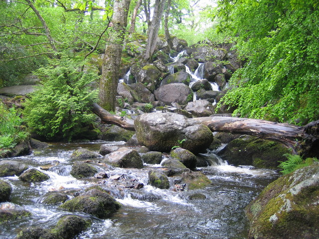
Image: © Nigel Cox Taken: 9 May 2007
From a strictly physical geographical point of view this is the Becka Falls waterfall on the Becka Brook, which is a tributary of the River Bovey. The water cascades here over a boulder-strewn bed with a fall of about 70 feet or about 20 metres. However the land in which they occur is privately owned, and the owners have unsurprisingly turned the site into a tourist attraction in which the falls are the centrepiece of a woodland park containing a variety of different features such as a children's zoo, pony paddocks, and the inevitable gift shop. In the course of this commercialization the name of the falls has metamorphosed from Becka, as shown on the OS 1940s map, into Becky, as shown on the current OS map. The falls were first made accessible to the public in 1903, and the park's website is here http://www.beckyfalls.com/index.php Adult admittance in May 2007 was £5.75 per person.
Images are licensed for reuse under creativecommons.org/licenses/by-sa/2.0
Image Location
Latitude
50.607422
Longitude
-3.75235