1
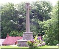
Casely Cleave
From Lustleigh Footpath 32, looking across Brookfield and the Wray Brook valley.
Image: © Derek Harper
Taken: 25 Jul 2010
0.12 miles
2
Wray Valley Trail
Looking in the opposite direction to
Image
Image: © Derek Harper
Taken: 16 Mar 2020
0.14 miles
3
Wray Valley Trail north of Lustleigh
The trail crosses an accommodation bridge with timber and wire fences as parapets. It is following the line of the former Moretonhampstead and South Devon Railway, here on a substantial embankment above the surrounding farmland.
Image: © Derek Harper
Taken: 16 Mar 2020
0.15 miles
4
Bridge on Wray Valley Trail
Image: © David Smith
Taken: 15 Jul 2021
0.15 miles
5
Wray Valley Trail
Descending very gently towards Lustleigh.
Image: © Guy Wareham
Taken: 20 Mar 2020
0.16 miles
6
The Bishop's Stone
Now part of a wall with railings the stone has a very faint coat-of-arms cut into it and it is thought might have been the base of a cross.
Image: © Guy Wareham
Taken: 13 Mar 2011
0.16 miles
7
Wray Valley Trail approaching Lustleigh
Recently opened, the Trail provides access along the Wray Brook valley using much of the lin of the dismantled Moretonhamostead railway. The cyclist is close to the point where the trail has to leave the route of the former railway and follow roads for nearly two kilometres.
Image: © Derek Harper
Taken: 16 Mar 2020
0.17 miles
8
Old Wayside Cross by Knowle Road, Lustleigh Parish
Bishop's Stone, old base, Starkey No.48 by the UC road, in parish of Lustleigh (Teignbridge District), Knowle Road, close to the T-junction, opposite drive to the old station, in a section of stone wall, within the railings.
Grade II listed. List Entry Number: 1097368
https://historicengland.org.uk/listing/the-list/list-entry/1097368
Surveyed
Milestone Society National ID: DVTE_LUS02
Image: © Alan Rosevear
Taken: 14 Aug 2009
0.17 miles
9
Wray Valley Trail approaching Caseley Cutting
The route of the former Moretonhampstead and South Devon Railway cuts through a shoulder on the valley side. Warning notices at each end say "risk of falling rocks - no stopping". I'm afraid we had no option - we needed our packed lunch and had encountered nowhere to sit on our route for miles, and there were suitable rocks to perch on at the start of the cutting. We didn't pass any further likely seats for the rest of our walk, either. The notice at the other end is shown in
Image
Image: © Derek Harper
Taken: 16 Mar 2020
0.17 miles
10
Memorial cross at Lustleigh
Erected in memory of the Rev Henry Tudor, Rector of Lustleigh, who died early in the 20th century.
Image: © T J Wright
Taken: 19 Jun 2005
0.18 miles


