Old Wayside Cross by Knowle Road, Lustleigh Parish
Introduction
The photograph on this page of Old Wayside Cross by Knowle Road, Lustleigh Parish by Alan Rosevear as part of the Geograph project.
The Geograph project started in 2005 with the aim of publishing, organising and preserving representative images for every square kilometre of Great Britain, Ireland and the Isle of Man.

There are currently over 7.5m images from over 14,400 individuals and you can help contribute to the project by visiting https://www.geograph.org.uk
Old Wayside Cross by Knowle Road, Lustleigh Parish
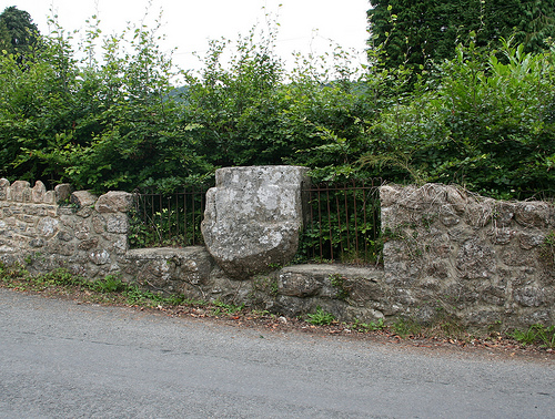
Image: © Alan Rosevear Taken: 14 Aug 2009
Bishop's Stone, old base, Starkey No.48 by the UC road, in parish of Lustleigh (Teignbridge District), Knowle Road, close to the T-junction, opposite drive to the old station, in a section of stone wall, within the railings. Grade II listed. List Entry Number: 1097368 https://historicengland.org.uk/listing/the-list/list-entry/1097368 Surveyed Milestone Society National ID: DVTE_LUS02
Images are licensed for reuse under creativecommons.org/licenses/by-sa/2.0
Image Location
Latitude
50.620829
Longitude
-3.717505