IMAGES TAKEN NEAR TO
Queens Road, NEWTON ABBOT, TQ13 8LP
Introduction
This page details the photographs taken nearby to Queens Road, TQ13 8LP by members of the Geograph project.
The Geograph project started in 2005 with the aim of publishing, organising and preserving representative images for every square kilometre of Great Britain, Ireland and the Isle of Man.

There are currently over 7.5m images from over14,400 individuals and you can help contribute to the project by visiting https://www.geograph.org.uk
Image Map
Images are licensed for reuse under creativecommons.org/licenses/by-sa/2.0
Notes
- Clicking on the map will re-center to the selected point.
- The higher the marker number, the further away the image location is from the centre of the postcode.
Image Listing (136 Images Found)
Images are licensed for reuse under creativecommons.org/licenses/by-sa/2.0
Image
Details
Distance
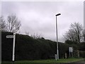
2
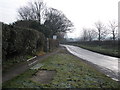
Moretonhampstead : A382
A Chagford Cross.
Image: © Lewis Clarke
Taken: 9 Dec 2022
0.13 miles
3
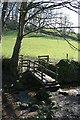
Footbridge over Wray Brook
Footbridge over the Wray Brook on Moretonhampstead footpath 16 between Shute Lane and Butterdon.
Image: © Hugh Craddock
Taken: 9 Mar 2009
0.14 miles
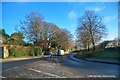
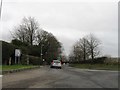
4
Moretonhampstead : Road
A road at Chagford Cross.
Image: © Lewis Clarke
Taken: 9 Dec 2022
0.14 miles
7
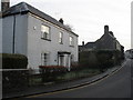
Lower end of Ford Street, Moretonhampstead
Image: © Roger Cornfoot
Taken: 10 Jan 2009
0.15 miles
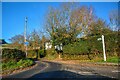
8

Moretonhampstead : Moretonhampstead Primary School
A school on Betton Way.
Image: © Lewis Clarke
Taken: 9 Dec 2022
0.16 miles
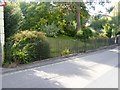
9
![Moretonhampstead houses [38]](https://s0.geograph.org.uk/geophotos/06/00/01/6000160_0fefe863_120x120.jpg)
Moretonhampstead houses [38]
Forder House was built circa 1800, is remarkably intact and has been virtually unaltered since it was built. It is unusual in having interior features of such high quality for a circa 1800 house. Listed, grade II, with details at: https://historicengland.org.uk/listing/the-list/list-entry/1147710 The railings are also listed, grade II, with details at: https://historicengland.org.uk/listing/the-list/list-entry/1097218
Image: © Michael Dibb
Taken: 28 Sep 2018
0.16 miles
10
Listed railings
These garden boundary railings to Forder Bungalow were originally the railings to a detached garden belonging to Forder House. Circa late 18th to early 19th century. Listed, grade II, with details at: https://historicengland.org.uk/listing/the-list/list-entry/1334220
Image: © Michael Dibb
Taken: 28 Sep 2018
0.16 miles