
IMAGES TAKEN NEAR TO
Chagford, NEWTON ABBOT, TQ13 8EE
Introduction
This page details the photographs taken nearby to TQ13 8EE by members of the Geograph project.
The Geograph project started in 2005 with the aim of publishing, organising and preserving representative images for every square kilometre of Great Britain, Ireland and the Isle of Man.

There are currently over 7.5m images from over14,400 individuals and you can help contribute to the project by visiting https://www.geograph.org.uk
Image Map
Images are licensed for reuse under creativecommons.org/licenses/by-sa/2.0
Notes
- Clicking on the map will re-center to the selected point.
- The higher the marker number, the further away the image location is from the centre of the postcode.
Image Listing (8 Images Found)
Images are licensed for reuse under creativecommons.org/licenses/by-sa/2.0
Image
Details
Distance
2
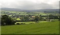
Lower Corndon
In the centre and right is Lower Corndon Farm and its associated cottages, with Higher Corndon Farm behind them. Seen from the lane shown in Image High Dartmoor broods in the distance.
Image: © Derek Harper
Taken: 27 Aug 2009
0.02 miles
3
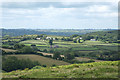
Chagford: Higher Corndon
Sunlit in mid image, with Western Corndon nearer the camera, in shadow, and Lower Corndon over to the right. In Chagford parish
Image: © Martin Bodman
Taken: 23 Jun 2011
0.06 miles


7
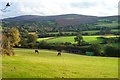
Fields near Corndon - Dartmoor
A quiet scene typical of the area of Dartmoor. The hills of Hameldown are on the horizon.
Image: © Fiona Avis
Taken: 22 Oct 2005
0.22 miles
8
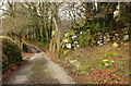
Lane near Downes
The lane down the southern slopes of Meldon Hill reaches a corner of the access land; enclosed fields are ahead.
Image: © Derek Harper
Taken: 6 Mar 2018
0.22 miles