
IMAGES TAKEN NEAR TO
Woodland, Ashburton, NEWTON ABBOT, TQ13 7JS
Introduction
This page details the photographs taken nearby to TQ13 7JS by members of the Geograph project.
The Geograph project started in 2005 with the aim of publishing, organising and preserving representative images for every square kilometre of Great Britain, Ireland and the Isle of Man.

There are currently over 7.5m images from over14,400 individuals and you can help contribute to the project by visiting https://www.geograph.org.uk
Image Map
Images are licensed for reuse under creativecommons.org/licenses/by-sa/2.0
Notes
- Clicking on the map will re-center to the selected point.
- The higher the marker number, the further away the image location is from the centre of the postcode.
Image Listing (22 Images Found)
Images are licensed for reuse under creativecommons.org/licenses/by-sa/2.0
Image
Details
Distance
1
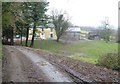
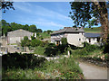
Merrifield
"Formerly (after about 1767) occupied by the curate of Woodland and possibly built as his residence" http://list.english-heritage.org.uk/resultsingle.aspx?uid=1249837&searchtype=mapsearch .
Image: © Derek Harper
Taken: 26 Mar 2006
0.01 miles
2
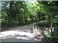
Bridge on a bend
The stream bridged here runs down from near Coombe Cross Image past Gurrington House and Orlycombe Image, soon joining the River Hems.
Image: © Robin Stott
Taken: 21 Jun 2010
0.07 miles
3
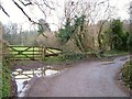
Lane near Merrifield
A bend in the lane from Quarry Farm, with a damp gateway, and the parapet of a bridge over a small stream.
Image: © Derek Harper
Taken: 26 Mar 2006
0.07 miles
4
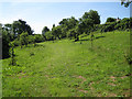
Orchard north of Gurrington House
It has a mix of old and young trees, like the one at Waye Farm Image Are orchards making a comeback?
Image: © Robin Stott
Taken: 21 Jun 2010
0.08 miles
6
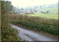
Quarry Farm
A view of Image from further up the lane towards Wickeridge Farm.
Image: © Derek Harper
Taken: 26 Mar 2006
0.13 miles
7
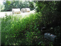
Field corner with power supply
These gadgets for powering temporary electric fences are everywhere. This one is disconnected for the moment - bales don't usually try to escape.
Image: © Robin Stott
Taken: 22 Jun 2010
0.15 miles
8
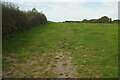
Field east of White Eagle
On the other side of the lane from Image
Image: © Derek Harper
Taken: 18 Sep 2020
0.16 miles
9
Black hole near Quarry Farm
OS Explorer shows disused quarries in the woodland on the hillside east of Quarry Farm. Not far away is Image
Image: © Robin Stott
Taken: 21 Jun 2010
0.18 miles
10
Lane and field east of White Eagle
The lane is from Orleycombe to Ashburton.
Image: © Derek Harper
Taken: 16 Jul 2015
0.20 miles