
IMAGES TAKEN NEAR TO
Lower Trindle Close, NEWTON ABBOT, TQ13 0FA
Introduction
This page details the photographs taken nearby to Lower Trindle Close, TQ13 0FA by members of the Geograph project.
The Geograph project started in 2005 with the aim of publishing, organising and preserving representative images for every square kilometre of Great Britain, Ireland and the Isle of Man.

There are currently over 7.5m images from over14,400 individuals and you can help contribute to the project by visiting https://www.geograph.org.uk
Image Map
Images are licensed for reuse under creativecommons.org/licenses/by-sa/2.0
Notes
- Clicking on the map will re-center to the selected point.
- The higher the marker number, the further away the image location is from the centre of the postcode.
Image Listing (26 Images Found)
Images are licensed for reuse under creativecommons.org/licenses/by-sa/2.0
Image
Details
Distance
1
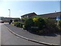
Twindle Beer, Chudleigh
Part of a modern development on the north-west of the town. What is the origin of this name?
Image: © David Smith
Taken: 12 Jul 2013
0.08 miles
2
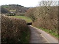
Lane near Chudleigh
The lane leads to a sewage works, and beneath the A38 (via Image) to Chudleigh Footpath 11a in the Teign valley. Across the valley is Lyneham Farm - see Image
Image: © Derek Harper
Taken: 16 Mar 2009
0.16 miles
3
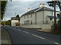
Orange Way in Devon and Torbay (156)
This is the B3344 which is the main road through Chudleigh.
Image: © Shazz
Taken: 20 Oct 2011
0.17 miles
4
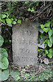
Old Milestone by the B3344, The Parade, Chudleigh
Carved stone post by the B3344 road (was A38), in parish of Chudleigh (Teignbridge District), The Parade, by Fern Cottage, 100m West of Police Station, in hedge bottom, on South side of road. Exeter tombstone erected by the Exeter turnpike trust in the 19th century.
Inscription reads:-
10
MILES
TO
EXETER
Grade II listed.
List Entry Number: 1440032 https://historicengland.org.uk/listing/the-list/list-entry/1440032
Milestone Society National ID: DV_EXCH10.
Image: © Alan Rosevear
Taken: 3 May 2011
0.17 miles
5
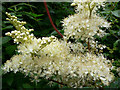
Meadowsweet in the hedgerows
Used to treat indigestion apparently.
Image: © paul dickson
Taken: 4 Jul 2008
0.17 miles
6
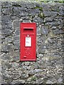
George VI postbox, Chudleigh
The postbox is near the Police Station.
Image: © Maigheach-gheal
Taken: 17 Aug 2008
0.17 miles
7
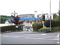
Chudleigh Police Station
The station is undergoing some refurbishment.
Image: © Maigheach-gheal
Taken: 17 Aug 2008
0.18 miles
8
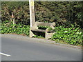
Sit, but don't stretch your legs out
And be aware that anyone who passes will have to step out into quite a busy road.
Image: © Jonathan Thacker
Taken: 14 Sep 2015
0.18 miles
9
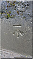
Benchmark Chudleigh
WALL SE SIDE RD NE SIDE HO BRYN (in OS database) - 61.1 m ASL - Station Hill. Near the Garden Centre/Nursery
Image: © Sheron Vowden
Taken: 30 Oct 2020
0.18 miles
10
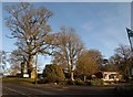
Entrance to the Rock Nursery, Chudleigh
Looking across the B3344 (the former A38). Associated with the nursery are the Rock Gardens, "set in the picturesque setting of the old Palace Quarry" http://www.therockgardens.co.uk/ .
Image: © Derek Harper
Taken: 12 Dec 2010
0.20 miles