
IMAGES TAKEN NEAR TO
Higher Budleigh Meadow, NEWTON ABBOT, TQ12 1UL
Introduction
This page details the photographs taken nearby to Higher Budleigh Meadow, TQ12 1UL by members of the Geograph project.
The Geograph project started in 2005 with the aim of publishing, organising and preserving representative images for every square kilometre of Great Britain, Ireland and the Isle of Man.

There are currently over 7.5m images from over14,400 individuals and you can help contribute to the project by visiting https://www.geograph.org.uk
Image Map
Images are licensed for reuse under creativecommons.org/licenses/by-sa/2.0
Notes
- Clicking on the map will re-center to the selected point.
- The higher the marker number, the further away the image location is from the centre of the postcode.
Image Listing (24 Images Found)
Images are licensed for reuse under creativecommons.org/licenses/by-sa/2.0
Image
Details
Distance
1
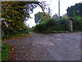
Ogwell Mill Road
Just beyond this point it changes from a surfaced road suitable for vehicles to a rather muddy track leading to a ford. The eponymous mill is now a house and shows little evidence of its former use from the public viewpoints.
Image: © Chris Allen
Taken: 3 Nov 2015
0.20 miles
2
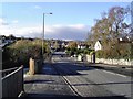
Highweek - Newton Abbot
This is the main Newton Abbot to Ashburton road on the western outskirts of this Devon market town.
Image: © Richard Knights
Taken: 4 Dec 2005
0.21 miles
3
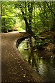
A Leat by the River Lemon
The footpath along the valley bottom running next to a disused leat.
Image: © Tony Atkin
Taken: 26 Sep 2009
0.23 miles
4
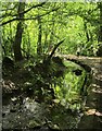
Mill Leat, Mellon's Copse
More or less a reverse view of Image, with Newton Abbot Footpath 9 heading up the Lemon valley. The leat served several mills in Newton Abbot, including Bradley Fellmongery Mill.
Image: © Derek Harper
Taken: 5 Jul 2015
0.23 miles

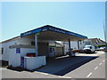
7
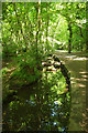
Mill Leat, Mellon's Copse
Followed by Newton Abbot Footpath 9.
Image: © Derek Harper
Taken: 27 May 2020
0.23 miles
8

Mill Leat, Mellon's Copse
This must be very close to the autumn view in Image, taken over ten years earlier. The path is Newton Abbot Footpath 9.
Image: © Derek Harper
Taken: 27 May 2020
0.23 miles
9
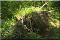
Uprooted tree, Mellon's Copse
Ferns grow on the root plate of a fallen tree just off the footpath.
Image: © Derek Harper
Taken: 27 May 2020
0.23 miles
10
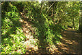
Path above the Lemon valley
The permissive path shown in Image] passes something on the left that might suit a small child or a deer. I may be in exploratory mode but I'm having none of it.
Image: © Derek Harper
Taken: 31 Oct 2021
0.23 miles