IMAGES TAKEN NEAR TO
The Exchange, Church Street, SOUTH BRENT, TQ10 9AE

Introduction

This page details the photographs taken nearby to The Exchange, Church Street, TQ10 9AE by members of the Geograph project.

The Geograph project started in 2005 with the aim of publishing, organising and preserving representative images for every square kilometre of Great Britain, Ireland and the Isle of Man.

There are currently over 7.5m images from over14,400 individuals and you can help contribute to the project by visiting https://www.geograph.org.uk

Image Map


Images are licensed for reuse under creativecommons.org/licenses/by-sa/2.0
Notes
  • Clicking on the map will re-center to the selected point.
  • The higher the marker number, the further away the image location is from the centre of the postcode.

Image Listing (160 Images Found)

Images are licensed for reuse under creativecommons.org/licenses/by-sa/2.0
  • ...
Image
Details
Distance
1
Church Street, South Brent
Image: © Ruth Sharville Taken: 12 Apr 2009
0.02 miles
2
Church Street, South Brent
As its name implies this street leads from the centre of the village to the parish church which is behind the photographer. What appear to be shops are now just shopfronts with the properties all converted to residential use. Thankfully, the village still has a good range of shops able to meet most of the needs of local residents.
Image: © Adrian Platt Taken: 19 Jul 2010
0.02 miles
3
Church Street, South Brent
Even Photoshop could do little with the extreme contrasts !
Image: © Adrian Platt Taken: 18 Dec 2010
0.02 miles
4
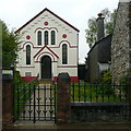
South Brent Methodist church
To quote the village design statement http://www.southbrent.gov.uk/fileadmin/user_upload/VDS/South_Brent_VDS.pdf on page 21: "Built in the late 19th Century in fine Italianate style".
Image: © Graham Horn Taken: 14 May 2012
0.02 miles
5
South Brent Methodist Church
Just off Church Street.
Image: © jeff collins Taken: 24 Apr 2014
0.02 miles
6
South Brent Methodist Church
Image: © Chris Allen Taken: 1 Apr 2015
0.02 miles
7
Cottages on Church Street, South Brent
Part of the scene can be spotted at the end of the street in Image Number 52, in the centre, is singled out in http://www.southbrent.co.uk/fileadmin/user_upload/SBPC/publications/other/South_Brent_Conservation_Area.pdf as "one of a diminishing number that still retains its original, multi-paned, painted-timber, vertical-sliding sash windows ... one of the very few with a doorcase surround that has a genuinely vernacular character".
Image: © Derek Harper Taken: 17 Oct 2010
0.02 miles
8
Old Toll House, South Brent
The former toll house, also seen in Image, juts out into Church Street. "Circa late C18 or early C19" http://www.britishlistedbuildings.co.uk/en-99363-old-toll-house-south-brent . The bellcote above the half gable was moved here from the Cheape House, a building nearby demolished in the C19. On the right is a pharmacy, and at the end of the street, a pink cottage at right angles to the street with a doorcase makes a distinctive closure to the view.
Image: © Derek Harper Taken: 17 Oct 2010
0.03 miles
9
Church Street
One of three main streets in South Brent. I'm afraid that on a wet Monday morning it has little appeal.
Image: © Graham Horn Taken: 14 May 2012
0.03 miles
10
Toll charge board, South Brent
The date on this board is 12 November, 1889. Quite specific for some items - 2/6 for a caravan is a hefty amount - and vague for others - "usual toll" for "every stall exposing articles of whatever description for sale in proportion to size and ground occupied". The building itself is shown in Image
Image: © Derek Harper Taken: 24 Apr 2011
0.04 miles
  • ...