Old Toll House, South Brent
Introduction
The photograph on this page of Old Toll House, South Brent by Derek Harper as part of the Geograph project.
The Geograph project started in 2005 with the aim of publishing, organising and preserving representative images for every square kilometre of Great Britain, Ireland and the Isle of Man.

There are currently over 7.5m images from over 14,400 individuals and you can help contribute to the project by visiting https://www.geograph.org.uk
Old Toll House, South Brent
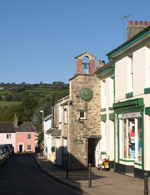
Image: © Derek Harper Taken: 17 Oct 2010
The former toll house, also seen in Image, juts out into Church Street. "Circa late C18 or early C19" http://www.britishlistedbuildings.co.uk/en-99363-old-toll-house-south-brent . The bellcote above the half gable was moved here from the Cheape House, a building nearby demolished in the C19. On the right is a pharmacy, and at the end of the street, a pink cottage at right angles to the street with a doorcase makes a distinctive closure to the view.
Images are licensed for reuse under creativecommons.org/licenses/by-sa/2.0
Image Location
Latitude
50.42626
Longitude
-3.835759