IMAGES TAKEN NEAR TO
The Close, Chequers Hill, EDENBRIDGE, TN8 7PF
Introduction
This page details the photographs taken nearby to The Close, Chequers Hill, TN8 7PF by members of the Geograph project.
The Geograph project started in 2005 with the aim of publishing, organising and preserving representative images for every square kilometre of Great Britain, Ireland and the Isle of Man.

There are currently over 7.5m images from over14,400 individuals and you can help contribute to the project by visiting https://www.geograph.org.uk
Image Map
Images are licensed for reuse under creativecommons.org/licenses/by-sa/2.0
Notes
- Clicking on the map will re-center to the selected point.
- The higher the marker number, the further away the image location is from the centre of the postcode.
Image Listing (71 Images Found)
Images are licensed for reuse under creativecommons.org/licenses/by-sa/2.0
Image
Details
Distance
4
Footpath to Bough Beech Sailing Club
This footpath from the railway at Bough Beech continues around the south side of Bough Beech Reservoir by the dam before crossing the access road to Bough Beech Sailing Club.
Image: © Marathon
Taken: 3 May 2014
0.06 miles
5
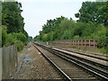
Tolls foot crossing, Bough Beech
The view east prior to a user crossing north to south.
This crossing was risk assessed in 2011 at individual risk D (scale A bad - M good) and collective risk 7 (scale 1 bad - 13 good). An assessment in 2014 changed the collective risk to 6. The stated line speed was 85 mph. There were 54 trains rising to 64 per day, 4 foot users per day.
These assessments are questionable, as neither mention the very limited visibility west for a north - south crosser. See Image and Image
Image: © Robin Webster
Taken: 3 Jul 2011
0.07 miles
7
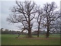
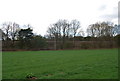
Three trees in a field
Seen from a footpath from Bough Beech Reservoir to the B2027 Clinton Lane in Bough Beech. In the background is Clout's Farm.
Image: © David Anstiss
Taken: 7 Feb 2010
0.08 miles
9
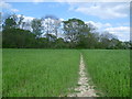
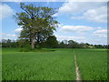
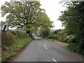
Footpath crossing a field near Bough Beech
This footpath from the railway at Bough Beech continues around the south side of Bough Beech Reservoir by the dam before crossing the access road to Bough Beech Sailing Club.
Image: © Marathon
Taken: 3 May 2014
0.09 miles
10
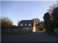
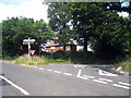
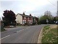
No longer a pub, Bough Beech
They have even kept the sign to remind people. It was called The Chequers but has not been a pub for many years.
Image: © David Howard
Taken: 10 Oct 2015
0.09 miles