IMAGES TAKEN NEAR TO
Saffron Grove, CROWBOROUGH, TN6 2GJ
Introduction
This page details the photographs taken nearby to Saffron Grove, TN6 2GJ by members of the Geograph project.
The Geograph project started in 2005 with the aim of publishing, organising and preserving representative images for every square kilometre of Great Britain, Ireland and the Isle of Man.

There are currently over 7.5m images from over14,400 individuals and you can help contribute to the project by visiting https://www.geograph.org.uk
Image Map
Images are licensed for reuse under creativecommons.org/licenses/by-sa/2.0
Notes
- Clicking on the map will re-center to the selected point.
- The higher the marker number, the further away the image location is from the centre of the postcode.
Image Listing (11 Images Found)
Images are licensed for reuse under creativecommons.org/licenses/by-sa/2.0
Image
Details
Distance
1
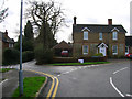
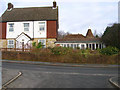
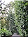
Holly Bank, Blackness Road
Blackness Road goes left to right whilst Luxford Road heads straight on. Blackness is another small hamlet that has been swallowed up by the Crowborough conurbation.
Image: © Simon Carey
Taken: 20 Jan 2007
0.09 miles
4
Wolfe Recreation Ground, Blackness Road, Crowborough
Wolfe Recreation Ground in Crowborough is located on land that once belonged to the family of General James Wolfe, remembered mainly for his defeat of the French in Canada and establishing British rule there - see http://en.wikipedia.org/wiki/James_Wolfe
Image: © Tim Tyler
Taken: 5 Mar 2007
0.18 miles
5
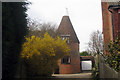
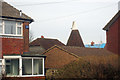
Blackness House, Blackness Road
Behind is Blackness Oasthouse a former farm building now swallowed up by the conurbation of Crowborough.
Image: © Simon Carey
Taken: 20 Jan 2007
0.20 miles
8
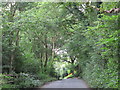
Public Byway near Cobblers Gardens
This links Mount Pleasant to Luxford Road.
Image: © Simon Carey
Taken: 20 Jan 2007
0.22 miles
10
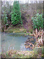
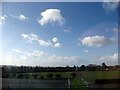
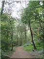
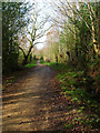
Pond, Jarvis Brook Country Park
Small country park on the site of former claypits which was part of a nearby brickworks. The sides of the pit are still visible in a number of places around the park.
Image: © Simon Carey
Taken: 20 Jan 2007
0.23 miles