IMAGES TAKEN NEAR TO
Walnut Way, TUNBRIDGE WELLS, TN4 9XU
Introduction
This page details the photographs taken nearby to Walnut Way, TN4 9XU by members of the Geograph project.
The Geograph project started in 2005 with the aim of publishing, organising and preserving representative images for every square kilometre of Great Britain, Ireland and the Isle of Man.

There are currently over 7.5m images from over14,400 individuals and you can help contribute to the project by visiting https://www.geograph.org.uk
Image Map
Images are licensed for reuse under creativecommons.org/licenses/by-sa/2.0
Notes
- Clicking on the map will re-center to the selected point.
- The higher the marker number, the further away the image location is from the centre of the postcode.
Image Listing (312 Images Found)
Images are licensed for reuse under creativecommons.org/licenses/by-sa/2.0
Image
Details
Distance
1
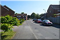
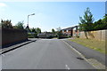
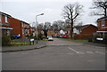
Hornbeam Avenue
All the street names on this mid 1980s estate are named after trees.
Image: © N Chadwick
Taken: 28 Feb 2009
0.04 miles
3
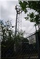
Communication Mast, High Broom Industrial Estate
Image: © N Chadwick
Taken: 21 Jun 2009
0.05 miles
8
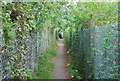
Mulberry Close
All the street names on this mid 1980s estate are named after trees.
Image: © N Chadwick
Taken: 28 Feb 2009
0.07 miles