IMAGES TAKEN NEAR TO
Netherfield Hill, BATTLE, TN33 0LA
Introduction
This page details the photographs taken nearby to Netherfield Hill, TN33 0LA by members of the Geograph project.
The Geograph project started in 2005 with the aim of publishing, organising and preserving representative images for every square kilometre of Great Britain, Ireland and the Isle of Man.

There are currently over 7.5m images from over14,400 individuals and you can help contribute to the project by visiting https://www.geograph.org.uk
Image Map (Loading...)


Getting Data...Please wait
Leaflet Map data © OpenStreetMap
Images are licensed for reuse under creativecommons.org/licenses/by-sa/2.0
Notes
- Clicking on the map will re-center to the selected point.
- The higher the marker number, the further away the image location is from the centre of the postcode.
Image Listing (10 Images Found)
Images are licensed for reuse under creativecommons.org/licenses/by-sa/2.0
Image
Details
Distance
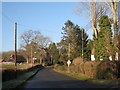
2
Netherfield Road
A C road that connects Battle to Netherfield, here crossing an unnamed tributary of the River Line.
Image: © Simon Carey
Taken: 13 Aug 2022
0.08 miles
3
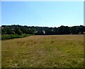
Little Meadow
The name of the field according to Battle's 1859 tithe map bounded by Beech Farm Lane to the north. Caldbec Hill is in the distance.
Image: © Simon Carey
Taken: 13 Aug 2022
0.10 miles
4
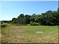
Brook Meadow
The name of the field according to Battle's 1859 tithe map that is located to the south of Netherfield Road.
Image: © Simon Carey
Taken: 13 Aug 2022
0.12 miles
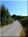
5
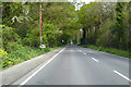
A2100 London Road
Heading north from Battle.
Image: © Robin Webster
Taken: 30 Apr 2019
0.21 miles
6
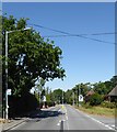
London Road, Battle
The current A2100 was built as a turnpike in 1836 replacing the older route which went via Caldbec Hill and Whatlington. The road runs in a straight line from Battle to John's Cross where it joins the A21.
Image: © Simon Carey
Taken: 13 Aug 2022
0.23 miles
8
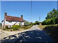
1-2, Wattle's Wish, Battle
An 18th century building that is now two dwellings.
Image: © Simon Carey
Taken: 13 Aug 2022
0.24 miles
9
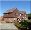
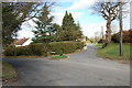
Lillybank, Battle
A new development of 50 houses located to the north of Wattle's Wish that has yet to be completed. Access is via London Road.
Image: © Simon Carey
Taken: 13 Aug 2022
0.24 miles
10
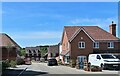
Part of Lillybank, a new development north of Battle
Image: © Patrick Roper
Taken: 6 May 2022
0.24 miles