IMAGES TAKEN NEAR TO
Brookland, ROMNEY MARSH, TN29 9RH
Introduction
This page details the photographs taken nearby to TN29 9RH by members of the Geograph project.
The Geograph project started in 2005 with the aim of publishing, organising and preserving representative images for every square kilometre of Great Britain, Ireland and the Isle of Man.

There are currently over 7.5m images from over14,400 individuals and you can help contribute to the project by visiting https://www.geograph.org.uk
Image Map (Loading...)


Getting Data...Please wait
Leaflet Map data © OpenStreetMap
Images are licensed for reuse under creativecommons.org/licenses/by-sa/2.0
Notes
- Clicking on the map will re-center to the selected point.
- The higher the marker number, the further away the image location is from the centre of the postcode.
Image Listing (13 Images Found)
Images are licensed for reuse under creativecommons.org/licenses/by-sa/2.0
Image
Details
Distance
1
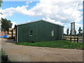
Marsh Produce Farm Shop
Part of Parish Farm on Rectory Lane.
Image: © David Anstiss
Taken: 12 Sep 2010
0.03 miles
2
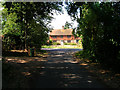
Brattle House, King Street near Brookland
Grade II listed building north of Brookland. Taken from Straight Lane before the junction with King Street.
Image: © Simon Carey
Taken: 5 Aug 2006
0.10 miles
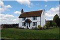
5
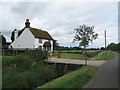
Brattle Cottage
On King Street. Beside the Brenzett Sewer, named drain in the Romney Marshes.
Image: © David Anstiss
Taken: 29 Aug 2010
0.11 miles
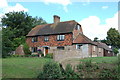
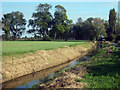
6
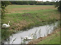
Swans in Brenzett Sewer
The Brenzett Sewer is a named drain in the Romney Marshes, running beside King Street towards Brenzett.
Moon House is in the background.
Image: © David Anstiss
Taken: 29 Aug 2010
0.12 miles
7
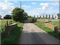
Rectory Lane road bridge
This lane leads from Brookland roundabout towards Brattle Farm on King Street.
It leads over the Baldwin Sewer.
Image: © David Anstiss
Taken: 12 Sep 2010
0.13 miles
8
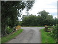
Lane junction on King Street
A lane from Brack Lane meets King Street.
It crosses over a bridge on the Brenzett Sewer, a named drain in the Romney Marshes.
Image: © David Anstiss
Taken: 29 Aug 2010
0.15 miles
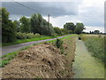
9
Brenzett Sewer
Running alongside Kings Street.
Image: © Oast House Archive
Taken: 17 Oct 2009
0.16 miles
10
Brenzett Sewer beside King Street
As seen from Image King Street leads from Brenzett towards Dean Court.
The Brenzett Sewer is a named drain in the Romney Marshes.
Image: © David Anstiss
Taken: 29 Aug 2010
0.17 miles