IMAGES TAKEN NEAR TO
West Place, ROMNEY MARSH, TN29 9RG
Introduction
This page details the photographs taken nearby to West Place, TN29 9RG by members of the Geograph project.
The Geograph project started in 2005 with the aim of publishing, organising and preserving representative images for every square kilometre of Great Britain, Ireland and the Isle of Man.

There are currently over 7.5m images from over14,400 individuals and you can help contribute to the project by visiting https://www.geograph.org.uk
Image Map
Images are licensed for reuse under creativecommons.org/licenses/by-sa/2.0
Notes
- Clicking on the map will re-center to the selected point.
- The higher the marker number, the further away the image location is from the centre of the postcode.
Image Listing (151 Images Found)
Images are licensed for reuse under creativecommons.org/licenses/by-sa/2.0
Image
Details
Distance
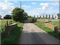
2
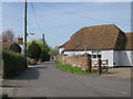
Salter's Lane
Salter's House ahead.
Image: © Oast House Archive
Taken: 21 Apr 2016
0.10 miles
5
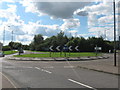
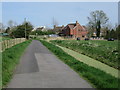
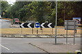
Brookland Roundabout
The A259 Straight Lane from Brenzett, heads straight to become Guldeford Lane leading towards Rye. Brookland High Street is on the left, heading into Brookland. On the right is Rectory Lane (unseen), leading to Mislesham, and Rye Road leading towards Salters Bridge.
Image: © David Anstiss
Taken: 12 Sep 2010
0.18 miles
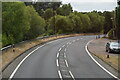

9
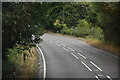
Rectory Lane road bridge
This lane leads from Brookland roundabout towards Brattle Farm on King Street.
It leads over the Baldwin Sewer.
Image: © David Anstiss
Taken: 12 Sep 2010
0.20 miles