IMAGES TAKEN NEAR TO
Bilsington, ASHFORD, TN25 7JN
Introduction
This page details the photographs taken nearby to TN25 7JN by members of the Geograph project.
The Geograph project started in 2005 with the aim of publishing, organising and preserving representative images for every square kilometre of Great Britain, Ireland and the Isle of Man.

There are currently over 7.5m images from over14,400 individuals and you can help contribute to the project by visiting https://www.geograph.org.uk
Image Map
Images are licensed for reuse under creativecommons.org/licenses/by-sa/2.0
Notes
- Clicking on the map will re-center to the selected point.
- The higher the marker number, the further away the image location is from the centre of the postcode.
Image Listing (12 Images Found)
Images are licensed for reuse under creativecommons.org/licenses/by-sa/2.0
Image
Details
Distance

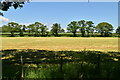
8
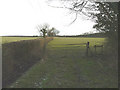
Stile near Honeypot Farm
A footpath follows the hedge in the direction of Swanton Farm, while another footpath follows the same course along the hedge but soon bears away in the direction of Hodge's Wood.
Image: © John Baker
Taken: 31 Jan 2010
0.23 miles
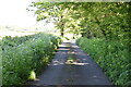
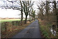
9
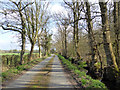
Swanton Lane
There is a well filled ditch on the right.
Image: © Robin Webster
Taken: 28 Mar 2017
0.24 miles