IMAGES TAKEN NEAR TO
Occupation Road, ASHFORD, TN25 5EN
Introduction
This page details the photographs taken nearby to Occupation Road, TN25 5EN by members of the Geograph project.
The Geograph project started in 2005 with the aim of publishing, organising and preserving representative images for every square kilometre of Great Britain, Ireland and the Isle of Man.

There are currently over 7.5m images from over14,400 individuals and you can help contribute to the project by visiting https://www.geograph.org.uk
Image Map
Images are licensed for reuse under creativecommons.org/licenses/by-sa/2.0
Notes
- Clicking on the map will re-center to the selected point.
- The higher the marker number, the further away the image location is from the centre of the postcode.
Image Listing (243 Images Found)
Images are licensed for reuse under creativecommons.org/licenses/by-sa/2.0
Image
Details
Distance
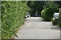
2
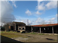
Former Wye College building, Occupation Road
This building has an ominous dip to its roof
Image: © John Baker
Taken: 20 Oct 2013
0.01 miles
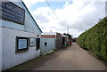
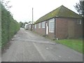
4
Derelict buildings off Occupation Road
Apparently disused outbuildings of Wye College.
Image: © Stephen Craven
Taken: 13 Apr 2013
0.01 miles
5
Former Wye College building, Occupation Road
Image: © John Baker
Taken: 20 Oct 2013
0.02 miles
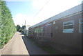
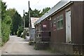
6
Former Wye College building, Occupation Road
Image: © John Baker
Taken: 20 Oct 2013
0.02 miles
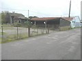
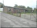
8
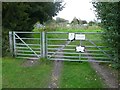
Entrance gates to Beanfield Allotments
From Occupation Road.
Image: © John Baker
Taken: 20 Oct 2013
0.04 miles
9
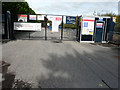
Wye School, Kempe Centre, Olantigh Road
Planning permission of amended plans has been granted by Ashford Borough Council under application number 16/01548/AMND/AS for a “revision to fenestration on teaching block and sports hall building and Kempe Centre; addition of roof ventilation turrets/rainwater pipes on teaching block and sports hall; flues to Kempe Centre, installation of a fence; addition of steps on Olantigh Road boundary; removal of trees to access substation; amendment to position of fence along Olantigh Road on planning permission 16/01548/AS (phases 2 and 3 of the proposed Wye School expansion comprising permanent use of the Kempe Centre for school use; refurbishment of the Kempe Centre to include new sixth form accommodation and minor alterations to the external appearance of the building to reflect internal reconfiguration; retention of the two existing temporary classroom cabins until the end of the 2018/2019 academic year; demolition of existing structures and some trees; erection of a new building comprising the main hall, 4-court sports hall and new teaching accommodation; new coach, car and cycle parking provision; new soft and hard landscaping; off-site highways works on Olantigh Road and other associated works)”.
The construction site is located beyond the gate at the far end of the road.
Image: © John Baker
Taken: 7 Oct 2018
0.05 miles