IMAGES TAKEN NEAR TO
Langholm Road, ASHFORD, TN23 4NJ
Introduction
This page details the photographs taken nearby to Langholm Road, TN23 4NJ by members of the Geograph project.
The Geograph project started in 2005 with the aim of publishing, organising and preserving representative images for every square kilometre of Great Britain, Ireland and the Isle of Man.

There are currently over 7.5m images from over14,400 individuals and you can help contribute to the project by visiting https://www.geograph.org.uk
Image Map
Images are licensed for reuse under creativecommons.org/licenses/by-sa/2.0
Notes
- Clicking on the map will re-center to the selected point.
- The higher the marker number, the further away the image location is from the centre of the postcode.
Image Listing (40 Images Found)
Images are licensed for reuse under creativecommons.org/licenses/by-sa/2.0
Image
Details
Distance
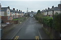
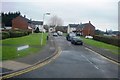
2
Jemmett Road
The land, beyond the fence, is an extension of a development called the Victoria Quarter.
Planning permission has been granted by Ashford Borough Council under application number 17/00354/AS for a “reserved matters application for the development of 160 dwellings together with access roads, footpaths, drainage, associated car/bicycle parking provision, ground works, landscaping, open space and infrastructure (pursuant to outline approval 11/00405/AS) “.
Image: © John Baker
Taken: 14 Oct 2019
0.08 miles
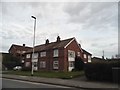
3
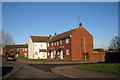
Houses on Langholm Road, Ashford, Kent
Image: © Oast House Archive
Taken: 10 Dec 2008
0.09 miles
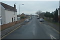
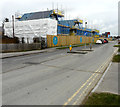
7
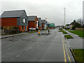
Jemmett Road
On the left are recently built houses and, in the distance, more that are under construction; they are part of a development called the Victoria Quarter.
This was a similar view of Image in March 2020.
Planning permission has been granted by Ashford Borough Council under application number 17/00354/AS for a “reserved matters application for the development of 160 dwellings together with access roads, footpaths, drainage, associated car/bicycle parking provision, ground works, landscaping, open space and infrastructure (pursuant to outline approval 11/00405/AS)“.
Image: © John Baker
Taken: 4 Jan 2021
0.11 miles
8
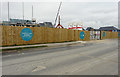
Jemmett Road
The land, beyond the fence, is an extension of a development called the Victoria Quarter. This was Image in October 2019.
Planning permission has been granted by Ashford Borough Council under application number 17/00354/AS for a “reserved matters application for the development of 160 dwellings together with access roads, footpaths, drainage, associated car/bicycle parking provision, ground works, landscaping, open space and infrastructure (pursuant to outline approval 11/00405/AS) “.
Image: © John Baker
Taken: 4 Mar 2020
0.11 miles
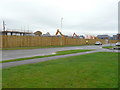
9
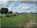
Beaver Road Allotments
On Beaver Road.
Image: © David Anstiss
Taken: 7 Aug 2010
0.11 miles
10
Jemmett Road
Circular notices affixed to the fence indicate that the houses beyond belong to an extension of a development called the Victoria Quarter.
Planning permission has been granted by Ashford Borough Council under application number 17/00354/AS for a “reserved matters application for the development of 160 dwellings together with access roads, footpaths, drainage, associated car/bicycle parking provision, ground works, landscaping, open space and infrastructure (pursuant to outline approval 11/00405/AS) “.
Image: © John Baker
Taken: 4 Mar 2020
0.12 miles