IMAGES TAKEN NEAR TO
Western Avenue, ASHFORD, TN23 1ND

Introduction

This page details the photographs taken nearby to Western Avenue, TN23 1ND by members of the Geograph project.

The Geograph project started in 2005 with the aim of publishing, organising and preserving representative images for every square kilometre of Great Britain, Ireland and the Isle of Man.

There are currently over 7.5m images from over14,400 individuals and you can help contribute to the project by visiting https://www.geograph.org.uk

Image Map


Images are licensed for reuse under creativecommons.org/licenses/by-sa/2.0
Notes
  • Clicking on the map will re-center to the selected point.
  • The higher the marker number, the further away the image location is from the centre of the postcode.

Image Listing (99 Images Found)

Images are licensed for reuse under creativecommons.org/licenses/by-sa/2.0
  • ...
Image
Details
Distance
1
Western Avenue, Ashford
Image: © Chris Whippet Taken: 2 Dec 2015
0.05 miles
2
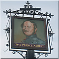
The Prince Albert pub sign
Sign outside the Prince Albert public house in New Street. See also Image
Image: © Richard Dorrell Taken: 30 Jul 2009
0.06 miles
3
The Prince Albert public house
Another pub looking for a new owner. The building stands in New Street on the roundabout junction of Barrow Hill and Chart Road. See also Image
Image: © Richard Dorrell Taken: 30 Jul 2009
0.07 miles
4
Roman Catholic church, Ashford
St. Teresa of Avila.
Image: © Robin Webster Taken: 4 Dec 2015
0.07 miles
5
Barrow Hill Place, Ashford
Image: © Chris Whippet Taken: 2 Dec 2015
0.07 miles
6
The Prince Albert, Ashford (closed)
It has a large hole in the roof, not very well sheeted over.
Image: © Robin Webster Taken: 4 Dec 2015
0.08 miles
7
Former Prince Albert pub, Ashford
This features in Private Eye's "Nooks & Corners" column this week. Apparently, the pub closed in 2008 and has been deliberately neglected ever since. In 2014 it was the subject of an arson attack - witness reports tell of a car "speeding away" from the burning building - and various architecturally important fixtures and fittings were stolen or vandalised over the years, including a Georgian door surround from the front door. Now the building is due for demolition and the site is to be redeveloped as housing, despite the deliberate neglect being the main reason for the restoration of the building being unviable.
Image: © John Winder Taken: 23 May 2016
0.08 miles
8
The Prince Albert, 109-11, New Street
The Ashford Herald reported that the derelict public house had been damaged by fire on 17 March 2014 http://www.ashfordherald.co.uk/update-prince-albert-pub/story-20823244-detail/story.html This may explain why there is a ripped, blue tarpaulin covering part of the roof.
Image: © John Baker Taken: 5 Jun 2016
0.08 miles
9
Apartment block, New Street
Planning permission has been granted by Ashford Borough Council under application number 17/01118/AS for the “demolition of existing public house[s] and associated buildings and erection of a five storey apartment building containing fourteen 2 bedroom units and 84m2 of commercial space at ground floor level including 14 car parking spaces, refuse and cycle storage and a vehicle lay-by.” The building is being constructed on the site of Image
Image: © John Baker Taken: 14 Oct 2019
0.09 miles
10
The Prince Albert sign
Image: © Oast House Archive Taken: 24 Nov 2010
0.09 miles
  • ...