IMAGES TAKEN NEAR TO
Forest View, UCKFIELD, TN22 3LF
Introduction
This page details the photographs taken nearby to Forest View, TN22 3LF by members of the Geograph project.
The Geograph project started in 2005 with the aim of publishing, organising and preserving representative images for every square kilometre of Great Britain, Ireland and the Isle of Man.

There are currently over 7.5m images from over14,400 individuals and you can help contribute to the project by visiting https://www.geograph.org.uk
Image Map
Images are licensed for reuse under creativecommons.org/licenses/by-sa/2.0
Notes
- Clicking on the map will re-center to the selected point.
- The higher the marker number, the further away the image location is from the centre of the postcode.
Image Listing (50 Images Found)
Images are licensed for reuse under creativecommons.org/licenses/by-sa/2.0
Image
Details
Distance
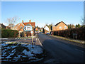
1
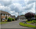
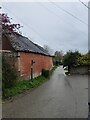
Forest View, Nutley
Modern cul de sac off Nether Lane.
Image: © Simon Carey
Taken: 2 Jun 2022
0.01 miles
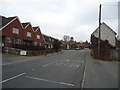
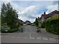
3
High Street
The A22 has it heads through Nutley viewed from the junction with Nether Lane the latter being the older droving route that heads directly south via Piltdown to Isfield. Behind the sign to Down Street is Nether Barn which has been converted into a residence with the old Memorial Hall the big building beyond. To the right is the Whitewood Stores the current village shop and post office.
Image: © Simon Carey
Taken: 9 Dec 2010
0.06 miles
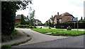
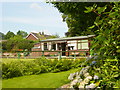
4
The Orchard, Nutley
Modern cul de sac off Nether Lane.
Image: © Simon Carey
Taken: 2 Jun 2022
0.06 miles
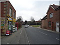
5
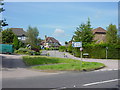
Junction
Junction of High Street with Nether Lane and The Orchard.
Image: © cynthia hudson
Taken: 9 Aug 2007
0.08 miles
8
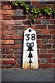
Old Milepost by the A22, High Street, Nutley
Metal plate attached to wooden post by the A22, in parish of MARESFIELD (WEALDEN District), High Street, Nutley, just North of the junction with Nursery Lane, in pavement against house wall, on East side of road. Bow Bells iron plate, erected by the Malling Street to Wych Cross turnpike trust in the 19th century.
Inscription reads:-
38
{Bow & 4 Bells}
East Sussex HER listed.
HER Ref: MES21811 https://www.heritagegateway.org.uk/Gateway/Results_Single.aspx?uid=MES21811&resourceID=1026
Milestone Society National ID: SX_LL38.
Image: © Keith Sharp
Taken: 31 Aug 2013
0.09 miles