High Street
Introduction
The photograph on this page of High Street by Simon Carey as part of the Geograph project.
The Geograph project started in 2005 with the aim of publishing, organising and preserving representative images for every square kilometre of Great Britain, Ireland and the Isle of Man.

There are currently over 7.5m images from over 14,400 individuals and you can help contribute to the project by visiting https://www.geograph.org.uk
High Street
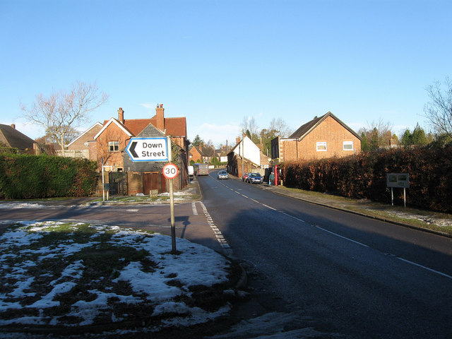
Image: © Simon Carey Taken: 9 Dec 2010
The A22 has it heads through Nutley viewed from the junction with Nether Lane the latter being the older droving route that heads directly south via Piltdown to Isfield. Behind the sign to Down Street is Nether Barn which has been converted into a residence with the old Memorial Hall the big building beyond. To the right is the Whitewood Stores the current village shop and post office.
Images are licensed for reuse under creativecommons.org/licenses/by-sa/2.0
Image Location
Latitude
51.028588
Longitude
0.055939