IMAGES TAKEN NEAR TO
Sicklehatch Lane, HEATHFIELD, TN21 0BX
Introduction
This page details the photographs taken nearby to Sicklehatch Lane, TN21 0BX by members of the Geograph project.
The Geograph project started in 2005 with the aim of publishing, organising and preserving representative images for every square kilometre of Great Britain, Ireland and the Isle of Man.

There are currently over 7.5m images from over14,400 individuals and you can help contribute to the project by visiting https://www.geograph.org.uk
Image Map (Loading...)


Getting Data...Please wait
Leaflet Map data © OpenStreetMap
Images are licensed for reuse under creativecommons.org/licenses/by-sa/2.0
Notes
- Clicking on the map will re-center to the selected point.
- The higher the marker number, the further away the image location is from the centre of the postcode.
Image Listing (26 Images Found)
Images are licensed for reuse under creativecommons.org/licenses/by-sa/2.0
Image
Details
Distance
1
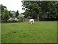
Horse in Farm at Twitterings
near Maynards Green
Image: © Paul Gillett
Taken: 27 May 2010
0.02 miles
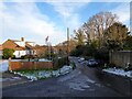
2
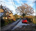
Greenleigh, Sicklehatch Lane, Maynards Green
Marked on Heathfield's 1841 tithe map but may have been rebuilt at some point.
Image: © Simon Carey
Taken: 17 Dec 2022
0.07 miles
3
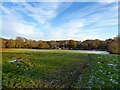
Bottle Field (1)
The name of the field according to Heathfield's 1841 tithe map located to the south of Sicklehatch Lane. The former field has been divided into two, this is the western portion, see Image for the other half.
Image: © Simon Carey
Taken: 17 Dec 2022
0.07 miles
4
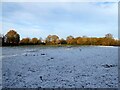
Bottle Field (2)
The name of the field according to Heathfield's 1841 tithe map that has been divided into two. This is the eastern part located to the south of Sicklehatch Lane and Leather Bottel Cottage, from which it derives its name, and north of Bottle Shaw. See Image for the western portion.
Image: © Simon Carey
Taken: 17 Dec 2022
0.08 miles
5
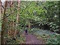
Sapperton Wood
near to Maynards Green in East Sussex
Image: © Paul Gillett
Taken: 27 May 2010
0.10 miles
6
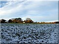
Barn Meadow
The name of the field according to Heathfield's 1841 tithe map located on the northern side of Sicklehatch Lane.
Image: © Simon Carey
Taken: 17 Dec 2022
0.11 miles
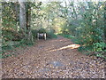
7
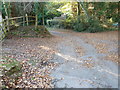
Sicklehatch Lane, Maynards Green
Heading east to Grantleys Farm where it ends.
Image: © Simon Carey
Taken: 17 Dec 2022
0.15 miles
9
Eastern end of Sicklehatch Lane Maynard's Green
Image: © Dave Spicer
Taken: 13 Nov 2011
0.16 miles
10
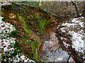
Stream, Bottle Shaw
An unnamed tributary of Waldron Gill with a steep eastern bank at this point.
Image: © Simon Carey
Taken: 17 Dec 2022
0.16 miles