IMAGES TAKEN NEAR TO
Westdown Park, ETCHINGHAM, TN19 7NW

Introduction

This page details the photographs taken nearby to Westdown Park, TN19 7NW by members of the Geograph project.

The Geograph project started in 2005 with the aim of publishing, organising and preserving representative images for every square kilometre of Great Britain, Ireland and the Isle of Man.

There are currently over 7.5m images from over14,400 individuals and you can help contribute to the project by visiting https://www.geograph.org.uk

Image Map


Images are licensed for reuse under creativecommons.org/licenses/by-sa/2.0
Notes
  • Clicking on the map will re-center to the selected point.
  • The higher the marker number, the further away the image location is from the centre of the postcode.

Image Listing (62 Images Found)

Images are licensed for reuse under creativecommons.org/licenses/by-sa/2.0
  • ...
Image
Details
Distance
1
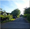
Westdown Park, Burwash Common
A private cul de sac off Westdown Lane built in the 1990s.
Image: © Simon Carey Taken: 29 May 2023
0.01 miles
2
Westdown Park
The private cul-de-sac Westdown Park and its houses.
Image: © Chris Thomas-Atkin Taken: 6 Jan 2019
0.03 miles
3
Long Meadow
The name of the field according to Burwash's 1839 tithe map that is now little more than rough ground and located west of Westdown Lane and north of Westdown Park.
Image: © Simon Carey Taken: 29 May 2023
0.06 miles
4
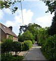
Path leaving Westdown Lane
A sturdy handrail is available on this section of the footpath leaving Westdown Lane.
Image: © Chris Thomas-Atkin Taken: 6 Jan 2019
0.06 miles
5
3-4, Highfield Cottages, Vicarage Lane, Burwash Common
Set back from Vicarage Lane with numbers 1-2 out of shot to the left. Possibly built between the wars as the ealiest reference I can find is a 1947 aerial photograph.
Image: © Simon Carey Taken: 29 May 2023
0.07 miles
6
Westdown Lane
Image: © Oast House Archive Taken: 4 Jun 2009
0.09 miles
7
Westdown Lane, Burwash Common
Private lane and public footpath that heads south to Westdown Farm. The cottages on the left are Meadow Side and Sunny View respectively and were built in the first decade of the 20th century.
Image: © Simon Carey Taken: 29 May 2023
0.10 miles
8
Stile off Vicarage Lane, Burwash Common
Image: © N Chadwick Taken: 6 Apr 2009
0.10 miles
9
Burwash Common Reservoir
First appeared on the 1909 OS map having previously been known as Three-Cornererd Field on Burwash's 1839 tithe map.
Image: © Simon Carey Taken: 29 May 2023
0.11 miles
10
Bohemia Farm
A church like looking building at Bohemia Farm viewed from Westdown Lane.
Image: © Chris Thomas-Atkin Taken: 6 Jan 2019
0.11 miles
  • ...