IMAGES TAKEN NEAR TO
Berrys Green Road, WESTERHAM, TN16 3AH
Introduction
This page details the photographs taken nearby to Berrys Green Road, TN16 3AH by members of the Geograph project.
The Geograph project started in 2005 with the aim of publishing, organising and preserving representative images for every square kilometre of Great Britain, Ireland and the Isle of Man.

There are currently over 7.5m images from over14,400 individuals and you can help contribute to the project by visiting https://www.geograph.org.uk
Image Map
Images are licensed for reuse under creativecommons.org/licenses/by-sa/2.0
Notes
- Clicking on the map will re-center to the selected point.
- The higher the marker number, the further away the image location is from the centre of the postcode.
Image Listing (17 Images Found)
Images are licensed for reuse under creativecommons.org/licenses/by-sa/2.0
Image
Details
Distance
1
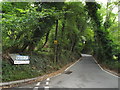
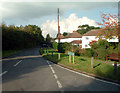
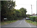
Berry's Hill, near Biggin Hill
Berry's Hill is a narrow lane leading to the hamlet of Berry's Green.
Despite its rural nature, this location lies within the Greater London boundary.
Image: © Malc McDonald
Taken: 21 Aug 2016
0.11 miles
2
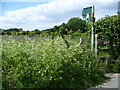
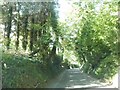
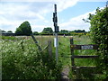
Footpath from Berry's Green Road
This footpath, seen from Berry's Green Road, splits into a number of paths but most head for the southern edge of Biggin Hill.
Image: © Marathon
Taken: 10 Jun 2015
0.12 miles
3
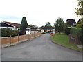
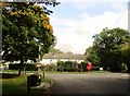
Restavon Park, Berry's Green, near Biggin Hill
Restavon Park is a development of static caravans at Berry's Green, near Biggin Hill.
Image: © Malc McDonald
Taken: 21 Aug 2016
0.12 miles
5
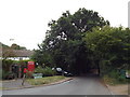
Single Street, Berry's Green TN16
Looking north from junction with Berry's Hill (to the right) and Jail Lane (to the left).
Image: © Philip Talmage
Taken: 17 Oct 2005
0.14 miles
7
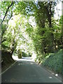
Berry's Hill, near Biggin Hill
Berry's Hill, leading to the hamlet of Berry's Green on the outermost fringe of south-east London.
Image: © Malc McDonald
Taken: 21 Aug 2016
0.16 miles
8
Jail Lane becomes Single Street
At the junction with Berry's Hill on the right
Image: © Martin Dawes
Taken: 8 Oct 2017
0.16 miles
9
Single Street, near Biggin Hill
Single Street is a small hamlet of houses along a single road near Biggin Hill, on the fringe of south-east London.
Image: © Malc McDonald
Taken: 21 Aug 2016
0.17 miles
10
Footpath at Berrys Green
This footpath, seen from Berry's Green Road, splits into a number of paths but most head for the southern edge of Biggin Hill.
Image: © Marathon
Taken: 10 Jun 2015
0.17 miles