IMAGES TAKEN NEAR TO
Single Street, WESTERHAM, TN16 3AA
Introduction
This page details the photographs taken nearby to Single Street, TN16 3AA by members of the Geograph project.
The Geograph project started in 2005 with the aim of publishing, organising and preserving representative images for every square kilometre of Great Britain, Ireland and the Isle of Man.

There are currently over 7.5m images from over14,400 individuals and you can help contribute to the project by visiting https://www.geograph.org.uk
Image Map
Images are licensed for reuse under creativecommons.org/licenses/by-sa/2.0
Notes
- Clicking on the map will re-center to the selected point.
- The higher the marker number, the further away the image location is from the centre of the postcode.
Image Listing (46 Images Found)
Images are licensed for reuse under creativecommons.org/licenses/by-sa/2.0
Image
Details
Distance
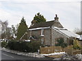
1
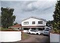
Modern house on Single Street, Berry's Green
Image: © David Howard
Taken: 17 Aug 2015
0.01 miles
3
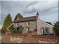
Cottage on Single Street, Berry's Green
I have been told some of these houses are actually brick faced with stone, an expert would be able to tell.
Image: © David Howard
Taken: 17 Aug 2015
0.02 miles
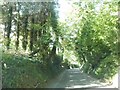
4
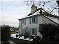
House on Single Street
Single Street leads from Jail Lane to Luxted Road.
Image: © David Anstiss
Taken: 9 Dec 2010
0.03 miles
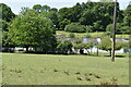
5
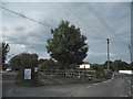
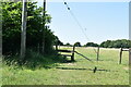
The entrance to Greatfield Farm, Berry's Green
Image: © David Howard
Taken: 17 Aug 2015
0.04 miles
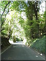
7
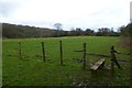
Stile in Single Street
At a junction of several paths just south of Single Street.
Image: © DS Pugh
Taken: 12 Dec 2015
0.11 miles