IMAGES TAKEN NEAR TO
Knighton Road, SEVENOAKS, TN14 5LE
Introduction
This page details the photographs taken nearby to Knighton Road, TN14 5LE by members of the Geograph project.
The Geograph project started in 2005 with the aim of publishing, organising and preserving representative images for every square kilometre of Great Britain, Ireland and the Isle of Man.

There are currently over 7.5m images from over14,400 individuals and you can help contribute to the project by visiting https://www.geograph.org.uk
Image Map
Images are licensed for reuse under creativecommons.org/licenses/by-sa/2.0
Notes
- Clicking on the map will re-center to the selected point.
- The higher the marker number, the further away the image location is from the centre of the postcode.
Image Listing (36 Images Found)
Images are licensed for reuse under creativecommons.org/licenses/by-sa/2.0
Image
Details
Distance
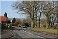
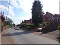
1
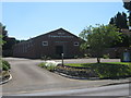
Otford Evangelical Free Church
On Pilgrims Way West.
Image: © David Anstiss
Taken: 30 May 2009
0.07 miles
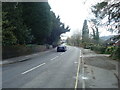
2
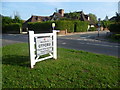
Welcome to OTFORD
This sign on Pilgrims Way West appears to be fairly new (at least it is not on Street View). It is on the western approach to Otford. Great Till Close is the road opposite.
Image: © Marathon
Taken: 28 Aug 2013
0.07 miles
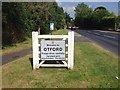
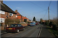
4
Twitton Meadows, Otford
This new housing development on the western edge of Otford takes its name from the nearby Twitton Lane and Twitton House.
Image: © Marathon
Taken: 28 Aug 2013
0.12 miles
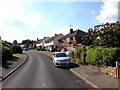
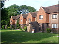
10
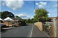
Telston Lane
Looking towards the junction with Pilgrims Way West.
Image: © DS Pugh
Taken: 11 Sep 2021
0.16 miles