IMAGES TAKEN NEAR TO
Nobridge, MARKET DRAYTON, TF9 3RA
Introduction
This page details the photographs taken nearby to TF9 3RA by members of the Geograph project.
The Geograph project started in 2005 with the aim of publishing, organising and preserving representative images for every square kilometre of Great Britain, Ireland and the Isle of Man.

There are currently over 7.5m images from over14,400 individuals and you can help contribute to the project by visiting https://www.geograph.org.uk
Image Map
Images are licensed for reuse under creativecommons.org/licenses/by-sa/2.0
Notes
- Clicking on the map will re-center to the selected point.
- The higher the marker number, the further away the image location is from the centre of the postcode.
Image Listing (9 Images Found)
Images are licensed for reuse under creativecommons.org/licenses/by-sa/2.0
Image
Details
Distance
1
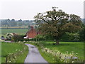
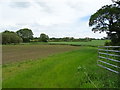
Nobridge farm
A typical farm lying on the fringe of a big country estate . Photographed while collecting data for a family research project.
Image: © Andrew Darge
Taken: 28 May 2004
0.05 miles
4
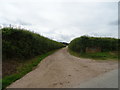
Track to Stychehall Farm
Looking south west from the lane.
Image: © JThomas
Taken: 1 Jun 2019
0.17 miles
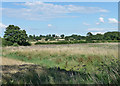
6
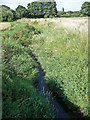
River Duckow near Longslow
The river starts not far from here and flows north into Cheshire.
Image: © Stephen Richards
Taken: Unknown
0.18 miles
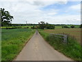
8
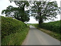
Minor road towards Longslow
Looking south east.
Image: © JThomas
Taken: 1 Jun 2019
0.20 miles
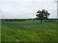
9
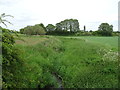
Farmland near Longslow
The embankment of the River Duckow (Image]) in the foreground.
Image: © Stephen Richards
Taken: Unknown
0.20 miles