
IMAGES TAKEN NEAR TO
Shropshire Street, MARKET DRAYTON, TF9 3DG
Introduction
This page details the photographs taken nearby to Shropshire Street, TF9 3DG by members of the Geograph project.
The Geograph project started in 2005 with the aim of publishing, organising and preserving representative images for every square kilometre of Great Britain, Ireland and the Isle of Man.

There are currently over 7.5m images from over14,400 individuals and you can help contribute to the project by visiting https://www.geograph.org.uk
Image Map
Images are licensed for reuse under creativecommons.org/licenses/by-sa/2.0
Notes
- Clicking on the map will re-center to the selected point.
- The higher the marker number, the further away the image location is from the centre of the postcode.
Image Listing (133 Images Found)
Images are licensed for reuse under creativecommons.org/licenses/by-sa/2.0
Image
Details
Distance
1
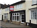
Market Drayton: 72a Shropshire Street
This property, currently (June 2016) for sale through commercial property surveyors and agents Towler Shaw Roberts, was formerly a bakery and bread shop called The Bread Bin. This name can still be seen as a 'ghost sign' in the front window, though not discernible in this photograph.
Image: © Jonathan Hutchins
Taken: 4 Jun 2016
0.00 miles
2
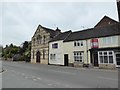
Market Drayton: 72a-78 Shropshire Street
No. 72a, on the extreme right, is a former bread shop (see http://www.geograph.org.uk/photo/4989500 ). No 78 was at one time a Kingdom Hall of Jehovah's Witnesses. In between are two residential cottages.
Image: © Jonathan Hutchins
Taken: 4 Jun 2016
0.01 miles
3
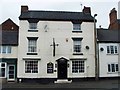
Coach & Horses, Shropshire St
The photograph was taken from the street opposite, called The Armoury, which according to the plaque on the wall, was:
House of the Poor
Site of the Parish Poor House, enlarged in 1788, rebuilt in 1839 to hold 100 people on the formation of the Drayton Poor Law Union. Closed in 1854 after a cholera outbreak. Later used as an armoury.
Image: © Mike White
Taken: 27 May 2009
0.01 miles
4
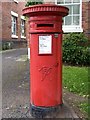
Victorian Post Box, Shropshire St.
What a nice big cylindrical one!
Image: © Mike White
Taken: 27 May 2009
0.01 miles
5
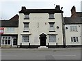
Market Drayton: the former Coach and Horses
No.72 Shropshire Street is a former pub and Grade II listed building described briefly in http://www.britishlistedbuildings.co.uk/en-260387-coach-and-horses-market-drayton-#.V1s4oVf8HOw . It was put up for sale in 2013 but had found no takers two years later.
Image: © Jonathan Hutchins
Taken: 4 Jun 2016
0.01 miles
6
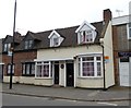
Market Drayton: 83 Shropshire Street
The Drayton Civic Society plaque beside the front door names it 'Gingerbread Bakery'. Market Drayton has been branded 'the home of gingerbread', which has been made here for over 200 years.
Image: © Jonathan Hutchins
Taken: 4 Jun 2016
0.02 miles
7
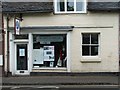
Drayton Museum, Shropshire St
The Story Of Drayton is closed on market day.
Image: © Mike White
Taken: 27 May 2009
0.03 miles
8
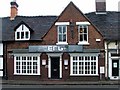
The Edge, Shropshire St
The sign says 'Happy Hour, £2 a Pint' and there's a cigarette stubber on the wall, so I think it's a pub.
Image: © Mike White
Taken: 27 May 2009
0.04 miles
9
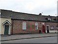
Market Drayton: The Old Chapel, 71 Shropshire Street
The plaque on the wall states 'Independent Methodist Church 1885'. It appears to be in use as a residential property, having previously been a bed showroom.
Image: © Jonathan Hutchins
Taken: 4 Jun 2016
0.04 miles
10
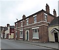
Market Drayton: Claremont House
No.67 Shropshire Street.
Image: © Jonathan Hutchins
Taken: 4 Jun 2016
0.05 miles