
IMAGES TAKEN NEAR TO
Riverside Avenue, TELFORD, TF8 7HY
Introduction
This page details the photographs taken nearby to Riverside Avenue, TF8 7HY by members of the Geograph project.
The Geograph project started in 2005 with the aim of publishing, organising and preserving representative images for every square kilometre of Great Britain, Ireland and the Isle of Man.

There are currently over 7.5m images from over14,400 individuals and you can help contribute to the project by visiting https://www.geograph.org.uk
Image Map
Images are licensed for reuse under creativecommons.org/licenses/by-sa/2.0
Notes
- Clicking on the map will re-center to the selected point.
- The higher the marker number, the further away the image location is from the centre of the postcode.
Image Listing (106 Images Found)
Images are licensed for reuse under creativecommons.org/licenses/by-sa/2.0
Image
Details
Distance
1

Riverside Avenue
The view from High Street Coalport by the River Severn.
Image: © Gordon Griffiths
Taken: 30 Apr 2019
0.02 miles
3

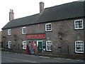
Cottages west of The Brewery Inn
A row of early 19th century cottages, which together with the pub at the far end, were given a Grade II listing https://www.britishlistedbuildings.co.uk/101206647-the-brewery-inn-the-gorge#.WVNZpOsrKM8 in 1974.
Image: © Richard Law
Taken: 9 Jun 2017
0.09 miles
4

Railway trackbed, Coalport
About to climb out of the gorge. Now a cycle path.
Image: © Richard Webb
Taken: 30 Jun 2014
0.09 miles
5

Old petrol pump, Coalport
This redundant and un-calibrated pump is still located on the roadside of Coalport's High Street. I think I recall the outbuilding off-shot to the right trading as a small garage/workshop many years ago, so this was presumably part of their operations. It has a mechanical dial and is marked only in gallons, which probably dates it to the early 1950s, and bears more than a passing resemblance to either an Avery Hardoll '101' or Avery Hardoll 'S' model.
Image: © Richard Law
Taken: 9 Jun 2017
0.09 miles
6
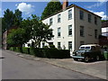
The former Nuway factory
This is the 'inner' view (as seen from the resident's access road) of the listed building https://www.britishlistedbuildings.co.uk/101367420-premises-occupied-by-the-nunway-manufacturing-company-limited-the-gorge#.WVNRz-srKM8 which was once a china warehouse and then a rubber products factory. Most recently converted to rather nice houses.
Image: © Richard Law
Taken: 9 Jun 2017
0.09 miles
8

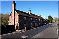
The former Nuway factory
A Grade II listed https://www.britishlistedbuildings.co.uk/101367420-premises-occupied-by-the-nunway-manufacturing-company-limited-the-gorge#.WVNRz-srKM8 19th century brick range of buildings, once occupied by the Nuway (or Nunway) Manufacturing Company, and which was originally used as a warehouse for the production and storage of china products, before being given over to the production of rubber mats and gaskets. It's now converted to housing.
Image: © Richard Law
Taken: 9 Jun 2017
0.10 miles
9

The Brewery Inn, Coalport
Riverside pub towards the eastern end of Coalport High Street.
Image: © Stephen McKay
Taken: 10 Oct 2015
0.11 miles
10

The Brewery Inn, Coalport High Street
A Grade II listed building https://www.britishlistedbuildings.co.uk/101206647-the-brewery-inn-the-gorge#.WVNZpOsrKM8, granted in 1974, as part of a set of early/mid 19th century cottages and inn within the conservation area of the lower Ironbridge Gorge.
Image: © Richard Law
Taken: 9 Jun 2017
0.11 miles