
IMAGES TAKEN NEAR TO
Coalport Road, TELFORD, TF8 7HN
Introduction
This page details the photographs taken nearby to Coalport Road, TF8 7HN by members of the Geograph project.
The Geograph project started in 2005 with the aim of publishing, organising and preserving representative images for every square kilometre of Great Britain, Ireland and the Isle of Man.

There are currently over 7.5m images from over14,400 individuals and you can help contribute to the project by visiting https://www.geograph.org.uk
Image Map
Images are licensed for reuse under creativecommons.org/licenses/by-sa/2.0
Notes
- Clicking on the map will re-center to the selected point.
- The higher the marker number, the further away the image location is from the centre of the postcode.
Image Listing (291 Images Found)
Images are licensed for reuse under creativecommons.org/licenses/by-sa/2.0
Image
Details
Distance
1

Path on former railway trackbed near Blists Hill
The railway climbed out of Ironbridge Gorge and up the valley side around Blists Hill.
Image: © David Martin
Taken: 11 Sep 2022
0.05 miles
2
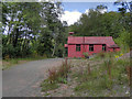
Mission Church, Blists Hill, Madeley
St Chad's Gospel Mission, a corrugated iron church at Blists Hill Victorian Town.
Image: © David Dixon
Taken: 9 Aug 2011
0.09 miles
3

Madeley Wood Co. Outdoor Adventure, Blists Hill
A superb playground and recent addition to Blists Hill, with plenty of space for children of all ages.
Image: © TCExplorer
Taken: 30 Aug 2024
0.09 miles
4

Tin Gospel Chapel,Blists Hill Victorian Town
A passport to
all the museums is a worth while investment.
Image: © Anthony Vosper
Taken: 28 Jul 2011
0.09 miles
5
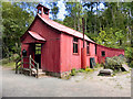
St Chad's Gospel Mission Church, Blists Hill, Madeley
Corrugated iron church at Blists Hill Victorian Town.
Image: © David Dixon
Taken: 9 Aug 2011
0.09 miles
6

Squatter's Cottage, Blists Hill Museum, Madeley, Salop.
Between 1797-1850 a considerable number of squatters’ cottages were built on unregulated wasteland by impoverished individuals who tolerated the annual fines - imposed upon them by manorial courts - for the convenience of living in rough, self-constructed homes near to their places of work, e.g. collieries. A substantial number of squatter communities evolved in this area and this particular cottage - from Burroughs Bank, a lasso shaped track immediately north of the A4169 - was saved from demolition and re-erected here. Until the early 1970s a squatter community survived on nearby Holywell Lane, although the many of the properties were demolished by the local council despite much local protest from local history enthusiasts.
Image: © David Hallam-Jones
Taken: 30 Oct 2019
0.09 miles
7
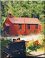
St Chad's Mission Church
A Victorian corrugated iron chapel which is now part of the Ironbridge Gorge Museum village.
From a print, date not exact.
Image: © Des Blenkinsopp
Taken: Unknown
0.10 miles
8
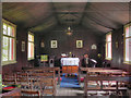
St Chad's Mission Church, Blists Hill
Inside Image]
Image: © David Dixon
Taken: 9 Aug 2011
0.10 miles
9

Tin tabernacle, Blists Hill Victorian Town
Built in 1888, St. Chad’s Mission Church, was moved from Muxton and re-erected here in 1977.
Image: © MrC
Taken: 20 Aug 2013
0.10 miles
10

Blists Hill Museum - chapel
An example of the once common corrugated iron chapel or 'tin tabernacle'. There are cast iron 'gravestones' alongside.
Image: © Chris Allen
Taken: 22 Aug 1998
0.10 miles