
IMAGES TAKEN NEAR TO
Buildwas Road, TELFORD, TF8 7BN
Introduction
This page details the photographs taken nearby to Buildwas Road, TF8 7BN by members of the Geograph project.
The Geograph project started in 2005 with the aim of publishing, organising and preserving representative images for every square kilometre of Great Britain, Ireland and the Isle of Man.

There are currently over 7.5m images from over14,400 individuals and you can help contribute to the project by visiting https://www.geograph.org.uk
Image Map
Images are licensed for reuse under creativecommons.org/licenses/by-sa/2.0
Notes
- Clicking on the map will re-center to the selected point.
- The higher the marker number, the further away the image location is from the centre of the postcode.
Image Listing (15 Images Found)
Images are licensed for reuse under creativecommons.org/licenses/by-sa/2.0
Image
Details
Distance

2
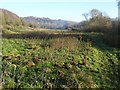
Pastureland beside the River Severn
Pastureland beside the River Severn near Ironbridge Gorge.
Image: © Philip Halling
Taken: 4 Dec 2019
0.12 miles
3

River Severn view Buildwas
Looking downstream from Buildwas road bridge.
Image: © kevin skidmore
Taken: 10 Oct 2008
0.14 miles
4

Fishing on The Severn
With the last remaining building of the Ironbridge A power station behind.
Image: © David Lally
Taken: 11 Sep 2010
0.15 miles
5

Remains of the Ironbridge A power station
No doubt about that with the architecture matching so well the construction period of 1929 - 32. Presumably still here due to the pipes visible which will be either abstracting or returning cooling water from the river; still needed by Ironbridge B power station.
The rest of the first power station was demolished in 1983 http://en.wikipedia.org/wiki/Buildwas_Power_Station .
For a view of the north-side of the working station see: Image
Image: © David Lally
Taken: 11 Sep 2010
0.16 miles
6

Ironbridge Power Station
Part of the disused Ironbridge Power Station viewed across the River Severn.
Image: © Philip Halling
Taken: 4 Dec 2019
0.16 miles
7

Ironbridge A Power Station Pumping Station
The pumping station is the only remaining building of Ironbridge A Power Station, which opened in 1932 and closed in 1981. Much of the power station was demolished in 1983 prior to being granted listed building status.
Image: © TCExplorer
Taken: 21 Jul 2023
0.16 miles
8
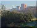
Cooling towers of Ironbridge Power Station
The cooling towers of Ironbridge Power Station pictured from the bridge over the River Severn near Buildwas.
Image: © Philip Halling
Taken: 4 Dec 2019
0.17 miles
9

The remains of the Ironbridge A station
Image: © Richard Law
Taken: 31 Oct 2010
0.18 miles
10

Severn Valley Way near Ironbridge Power Station
Image: © Row17
Taken: 16 Mar 2010
0.19 miles