
IMAGES TAKEN NEAR TO
The Wharfage, TELFORD, TF8 7AW
Introduction
This page details the photographs taken nearby to The Wharfage, TF8 7AW by members of the Geograph project.
The Geograph project started in 2005 with the aim of publishing, organising and preserving representative images for every square kilometre of Great Britain, Ireland and the Isle of Man.

There are currently over 7.5m images from over14,400 individuals and you can help contribute to the project by visiting https://www.geograph.org.uk
Image Map
Images are licensed for reuse under creativecommons.org/licenses/by-sa/2.0
Notes
- Clicking on the map will re-center to the selected point.
- The higher the marker number, the further away the image location is from the centre of the postcode.
Image Listing (812 Images Found)
Images are licensed for reuse under creativecommons.org/licenses/by-sa/2.0
Image
Details
Distance
1
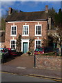
No 11, The Wharfage, Ironbridge
Grade II listed https://www.britishlistedbuildings.co.uk/101374367-11-the-wharfage-the-gorge#.WpBU39SLTGg in 1974, this is a mid 18th century red-brick town house which sits amongst several other listed properties on the main road through Ironbridge.
Image: © Richard Law
Taken: 17 Feb 2018
0.01 miles
5
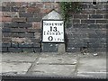
⅛-milestone
This milestone declares a distance of 0 miles, 1 furlong (⅛ mile) to Ironbridge and 13 to Shrewsbury. It is comfortably within what one would recognise as Ironbridge village, if ever it wasn't.
Image: © Chris Downer
Taken: 16 Dec 2007
0.01 miles
6
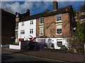
Nos 12, 13 & 14, The Wharfage, Ironbridge
A range of collectively Grade II listed https://www.britishlistedbuildings.co.uk/101207961-12-14-the-wharfage-the-gorge#.WpBSbtSLTGg 18th century houses, the listing being given in 1974. At the time of listing, nos 12 & 13 (nearest the camera) were described as having a projecting bay with shop fronts, but that seems to have been removed, taking the appearances back much closer to their original features. No 14 is half in shadow here, unfortunately.
Image: © Richard Law
Taken: 17 Feb 2018
0.01 miles
7
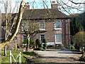
Severn Lodge, New Road, Ironbridge
A particularly fine early 19th century town house, which was Grade II listed https://www.britishlistedbuildings.co.uk/101038658-severn-lodge-the-gorge#.WpBWMNSLTGg in 1974.
Image: © Richard Law
Taken: 17 Feb 2018
0.01 miles
8
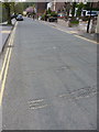
Flood defence damage to the road surface
In early 2020, two wet storms in fairly close succession led to high water levels along much of the Severn, and the flood defences seen in Image were deployed by the Environment Agency and the local council. They weren't quite overtopped on this occasion (although it was very close-run thing) but the sheer mass of water coming down the river for days on end caused a number of the aluminium frames to be unexpectedly pushed backwards across the width of the road - they were effectively stopped from going any further by the kerb on the far side. These deep scratches in the wearing course are the evidence of that event. I suspect there will be design modifications made to the frames or their deployment plan before they are next needed.
Image: © Richard Law
Taken: 16 Apr 2020
0.02 miles
10
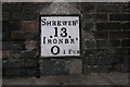
Mile and Furlong Post
This milepost in Ironbridge is located 13 miles from Shrewsbury and 0 miles and one furlong from Ironbridge
Image: © Michael Patterson
Taken: 25 Jan 2006
0.02 miles